File:1818 Tullavahajah map.PNG
Jump to navigation
Jump to search

Size of this preview: 800 × 593 pixels. Other resolution: 984 × 730 pixels.
Original file (984 × 730 pixels, file size: 1.61 MB, MIME type: image/png)
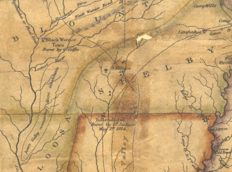
Detail of "Map of Alabama constructed from the surveys in the General Land Office and other documents." by John Melish (1818) showing Mud Town (Tullavahajah) on the Cahaba River. From "Historical Maps of Alabama: Before 1820" at alabamamaps.ua.edu (link)
| Public Domain | |
| This work was published in the United States before 1928 and is now presumed to be in the public domain. | |
| Media Type: Map | |
| This is a map or part of a map, the design of which may be protected by copyright. | |
File history
Click on a date/time to view the file as it appeared at that time.
| Date/Time | Thumbnail | Dimensions | User | Comment | |
|---|---|---|---|---|---|
| current | 15:46, 9 May 2016 | | 984 × 730 (1.61 MB) | Dystopos (talk | contribs) | Detail of "Map of Alabama constructed from the surveys in the General Land Office and other documents." by John Melish (1818) showing Mud Town (Tullavahajah) on the Cahaba River. From "Historical Maps of Alabama: Before 1820" at alabamamaps.ua.... |
You cannot overwrite this file.
File usage
The following 2 pages use this file: