File:1916 10 18 iso.gif
Jump to navigation
Jump to search

Size of this preview: 531 × 599 pixels. Other resolution: 647 × 730 pixels.
Original file (647 × 730 pixels, file size: 68 KB, MIME type: image/gif)
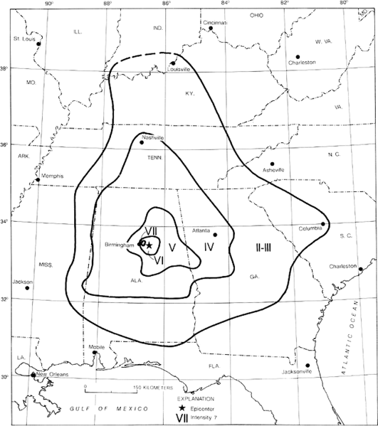
USGS isometric map of the 1916 earthquake centered on Irondale.
| This work is in the public domain | |
| This work was created by the United States Government and is in the public domain. | |
File history
Click on a date/time to view the file as it appeared at that time.
| Date/Time | Thumbnail | Dimensions | User | Comment | |
|---|---|---|---|---|---|
| current | 11:15, 14 December 2012 | | 647 × 730 (68 KB) | Wheresdib (talk | contribs) | USGS isometric map of the 1916 earthquake centered on Irondale. {{Template:PD-Gov}} |
You cannot overwrite this file.
File usage
The following 2 pages use this file: