File:1957 Oporto Avenue map.PNG
Jump to navigation
Jump to search

No higher resolution available.
1957_Oporto_Avenue_map.PNG (538 × 557 pixels, file size: 406 KB, MIME type: image/png)
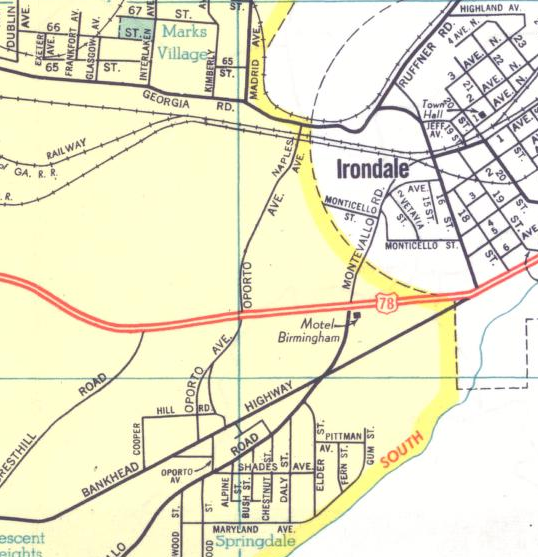
Detail from a 1957 Standard Oil Co. road map of Birmingham showing the former route of Oporto Avenue prior to construction of Eastwood Mall, I-20, and Oporto-Madrid Boulevard. (link)
| Fair Use media | |
| This work is subject to copyright and/or trade mark protection. It is used here without express permission under the legal doctrine of Fair Use. Rights to the work remain the sole property of the creator. See Bhamwiki:Copyrights for further information. | |
| Media Type: Map | |
| This is a map or part of a map, the design of which may be protected by copyright. | |
File history
Click on a date/time to view the file as it appeared at that time.
| Date/Time | Thumbnail | Dimensions | User | Comment | |
|---|---|---|---|---|---|
| current | 09:57, 7 January 2016 | | 538 × 557 (406 KB) | Dystopos (talk | contribs) | Detail from a 1957 Standard Oil Co. road map of Birmingham showing the former route of Oporto Avenue prior to construction of Eastwood Mall, I-20, and Oporto-Madrid Boulevard. {{Fair Use}} {{Map}} |
You cannot overwrite this file.
File usage
The following page uses this file: