File:Rickwood site plan.png
Jump to navigation
Jump to search
Size of this preview: 555 × 599 pixels. Other resolution: 1,100 × 1,188 pixels.
Original file (1,100 × 1,188 pixels, file size: 214 KB, MIME type: image/png)
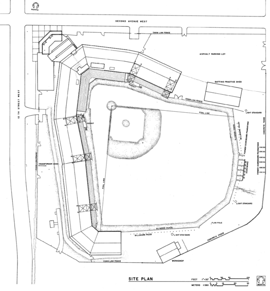
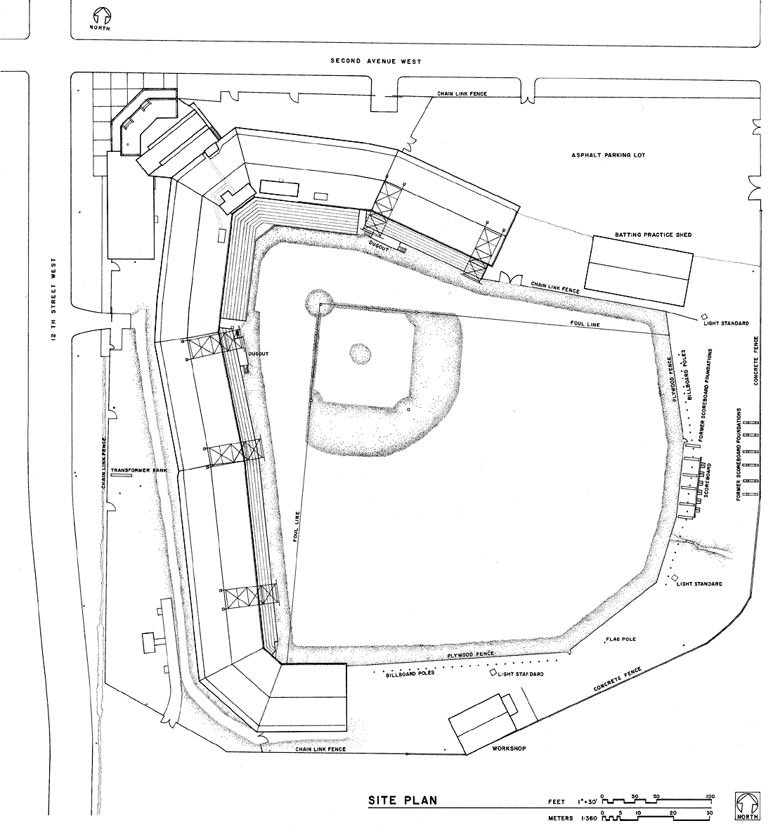
Site Plan. portion of Drawing Sheet 2 of 22. "Rickwood Field, 1137 2nd Avenue West, Birmingham, Jefferson County, Alabama" Historic American Buildings Survey. National Park Service. John P. White, delineator. Birmingham District Recording Project 1993. AL 897.
Licensing
| Historic American Buildings Survey | |
| This work was created for the United States Government and is part of the public domain. | |
File history
Click on a date/time to view the file as it appeared at that time.
| Date/Time | Thumbnail | Dimensions | User | Comment | |
|---|---|---|---|---|---|
| current | 13:06, 22 November 2006 | | 1,100 × 1,188 (214 KB) | Dystopos (talk | contribs) | Site Plan. portion of Drawing Sheet 2 of 22. "Rickwood Field, 1137 2nd Avenue West, Birmingham, Jefferson County, Alabama" Historic American Buildings Survey. National Park Service. John P. White, delineator. Birmingham District Recording Project 1993. AL |
You cannot overwrite this file.
File usage
The following page uses this file: