File:1889 Red Mtn Cemetery map.jpg
Jump to navigation
Jump to search

Size of this preview: 730 × 599 pixels. Other resolution: 849 × 697 pixels.
Original file (849 × 697 pixels, file size: 281 KB, MIME type: image/jpeg)
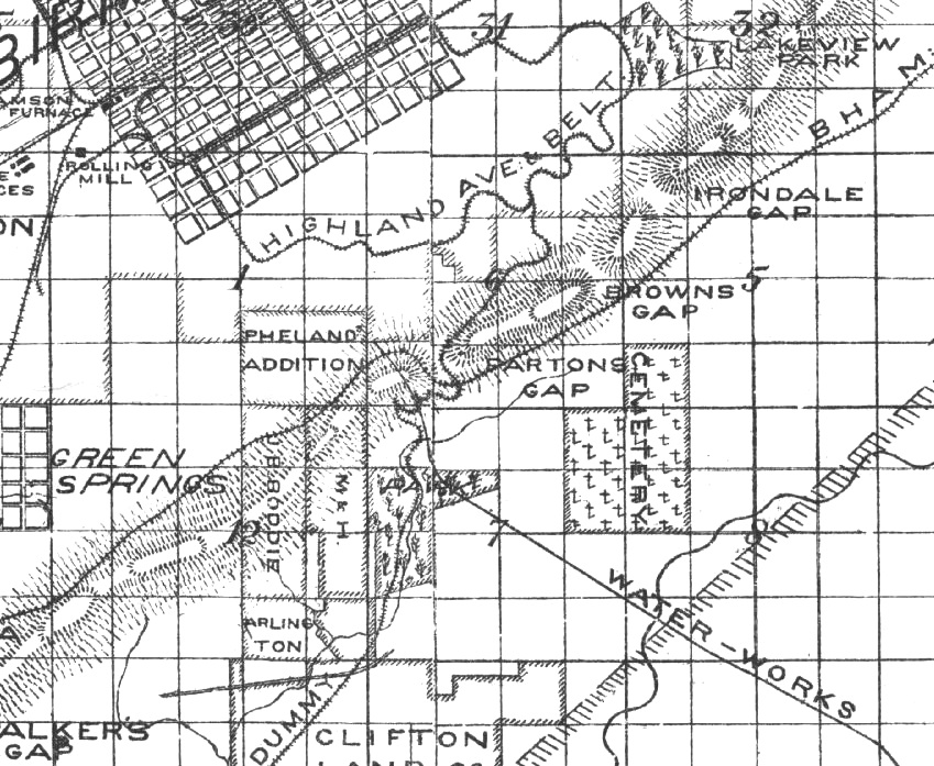
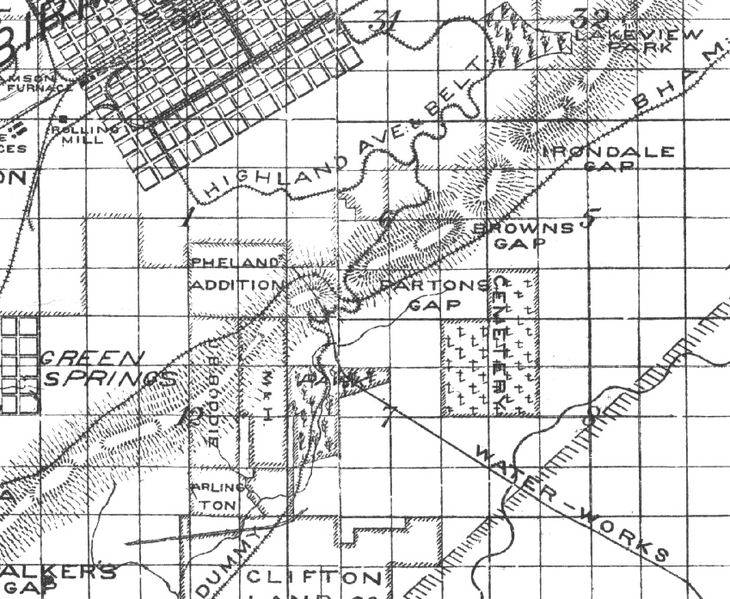
Detail of E. Grieg's 1889 "Map of Jefferson County, Alabama" (link) showing the extent of the property of the Red Mountain Cemetery, later dedicated as Lane Park.
| Public Domain | |
| This work was published in the United States before 1928 and is now presumed to be in the public domain. | |
| Media Type: Map | |
| This is a map or part of a map, the design of which may be protected by copyright. | |
File history
Click on a date/time to view the file as it appeared at that time.
| Date/Time | Thumbnail | Dimensions | User | Comment | |
|---|---|---|---|---|---|
| current | 09:47, 10 June 2016 | | 849 × 697 (281 KB) | Dystopos (talk | contribs) | Detail of E. Grieg's 1889 "Map of Jefferson County, Alabama" ([http://bplonline.cdmhost.com/cdm/ref/collection/p4017coll7/id/370 link]) showing the extent of the property of the Red Mountain Cemetery, later dedicated as Lane Park. {{PD}} {{Map}} |
You cannot overwrite this file.
File usage
The following page uses this file: