File:1891 ruins of fire.png
Jump to navigation
Jump to search

No higher resolution available.
1891_ruins_of_fire.png (460 × 385 pixels, file size: 221 KB, MIME type: image/png)
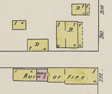
1891 Sanborn Map Company map showing "ruins of fire" at the site of the former New York Model Bakery at 212 22nd Street South (link)
| Public Domain | |
| This work was published in the United States before 1928 and is now presumed to be in the public domain. | |
File history
Click on a date/time to view the file as it appeared at that time.
| Date/Time | Thumbnail | Dimensions | User | Comment | |
|---|---|---|---|---|---|
| current | 08:45, 10 May 2019 | | 460 × 385 (221 KB) | Dystopos (talk | contribs) | 1891 Sanborn Map Company map showing "ruins of fire" at the site of the former New York Model Bakery at 212 22nd Street South ([https://www.loc.gov/resource/g3974bm.g3974bm_g000151891/?sp=12&r=0.308,0.512,0.296,0.193,0 link]) {{PD}} |
You cannot overwrite this file.
File usage
The following page uses this file: