File:35th Avenue Superfund Site map.png
Jump to navigation
Jump to search

No higher resolution available.
35th_Avenue_Superfund_Site_map.png (640 × 596 pixels, file size: 782 KB, MIME type: image/png)
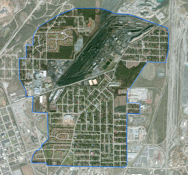
Aerial photograph with an outline of the 35th Avenue Superfund Site, adapted from "EPA Study Area, 35th Avenue Superfund Site, Birmingham, Jefferson County, Alabama" from the U.S. Environmental Protection Agency (link)
| This work is in the public domain | |
| This work was created by the United States Government and is in the public domain. | |
File history
Click on a date/time to view the file as it appeared at that time.
| Date/Time | Thumbnail | Dimensions | User | Comment | |
|---|---|---|---|---|---|
| current | 16:50, 9 May 2020 | | 640 × 596 (782 KB) | Dystopos (talk | contribs) | Aerial photograph with an outline of the 35th Avenue Superfund Site, adapted from "EPA Study Area, 35th Avenue Superfund Site, Birmingham, Jefferson County, Alabama" from the U.S. Environmental Protection Agency ([https://www.epa.gov/sites/producti... |
You cannot overwrite this file.
File usage
The following page uses this file: