Ohatchee
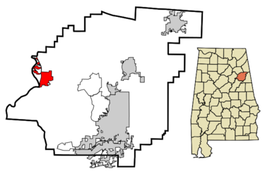
Ohatchee is a town of 1,170 on 5.9 square miles at the confluence of Tallasseehatchee Creek and Ohatchee Creek, near the Coosa River below Neely Henry Dam in western Calhoun County. It was incorporated in 1956 and is part of the Anniston-Oxford Metropolitan Statistical Area. Alabama State Highway 144 bisects the town and connects it to Ragland on the west and Alexandria on the east. Alabama State Highway 77 skirts the town's western edge, heading to Southside to the north and Lincoln to the south.
The Ohatchee Town Hall is located at 7801 Highway 77. Steve Baswell is the mayor. Ohatchee Town Council members include Perry Howard, Anthony Crosson, Celeisa Kilgore, Teresa Lott, Suzanne Frederick and J. M. Mitchell. The city operates the Ohatchee Fire Department and Ohatchee Police Department. Children in Ohatchee attend Calhoun County Schools.
Montgomery businessman Alfred Janney had an iron furnace built near Ohatchie with slave labor in 1863. The nearly-completed furnace was destroyed on July 14, 1864 by a detachment from Lovell Rousseau's cavalry under the command of Captain Ed Ruger. The stone breastwork of the furnace survived and is presently a centerpiece of Janney Furnace Park, operated by the Calhoun County Commission.
Ohatchee suffered damage from the 1994 Palm Sunday tornado outbreak, and again from the April 27, 2011 tornado outbreak.
Demographics
year     pop.     %change

1960 |   437 |       -  |
1970 |   445 |   +1.8%  |
1980 |   860 |  +93.3%  |
1990 | 1,042 |  +21.2%  |
2000 | 1,215 |  +16.6%  |
2010 | 1,170 |   -3.7%  |
2016 | 1,138 |   -2.7%  |
As of the census of 2010, there were 1,170 people, 474 households, and 361 families residing in the town. The population density was 198 people per square mile. There were 571 housing units at an average density of 96.8 per square mile. The racial makeup of the town was 94.1% White, 3.2% Black or African American, and 2.1% from two or more races. Less than 1% of the town's population was Latino or Hispanic of any race.
There were 474 households out of which 25.5% had children under the age of 18 living with them, 61.8% were married couples living together, 9.9% had a female householder with no husband present, and 23.8% were non-families. 22.2% of all households were made up of individuals and 8.3% had someone living alone who was 65 years of age or older. The average household size was 2.47 and the average family size was 2.84.
In the town, the age distribution of the population shows 21.1% under the age of 18, 7.1% from 18 to 24, 22.6% from 25 to 44, 35.0% from 45 to 64, and 14.1% who were 65 years of age or older. The median age was 44.4 years. For every 100 females, there were 105.3 males. For every 100 females age 18 and over, there were 99.0 males.
The median income for a household in the town was $55,769, and the median income for a family was $62,266. Males had a median income of $50,817 versus $26,563 for females. The per capita income for the town was $23,041. About 3.4% of families and 4.6% of the population were below the poverty line, including 1.6% of those under age 18 and 8.1% of those age 65 or over.
Notable people
- Homer Longoria, evangelist
- Clyde Propst (1898-1959), football coach
- Robert Propst (born 1931), Federal judge
- Rush Propst (born 1958), football coach
- Tom Sims, co-writer/illustrator of "Popeye the Sailor Man" comics (1938-1955)
- Steve Spencer (born 1945), ADEM field officer
References
- "Ohatchee, Alabama (May 23, 2018) Wikipedia - accessed July 6, 2018
