File:Slag Pile 1903 map.png
Jump to navigation
Jump to search

No higher resolution available.
Slag_Pile_1903_map.png (497 × 398 pixels, file size: 403 KB, MIME type: image/png)
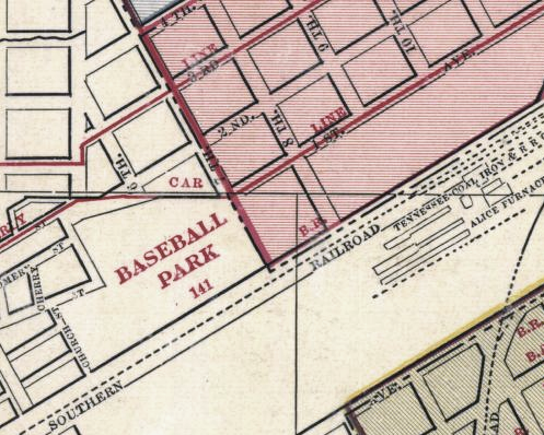
"Baseball Park" (Slag Pile Field) on George B. Kelley's 1903 "Map of Birmingham, Alabama and Adjacent Suburbs" (link)
| Public Domain | |
| This work was published in the United States before 1928 and is now presumed to be in the public domain. | |
File history
Click on a date/time to view the file as it appeared at that time.
| Date/Time | Thumbnail | Dimensions | User | Comment | |
|---|---|---|---|---|---|
| current | 10:38, 11 May 2014 | | 497 × 398 (403 KB) | Dystopos (talk | contribs) | "Baseball Park" (Slag Pile Field) on George B. Kelley's 1903 "Map of Birmingham, Alabama and Adjacent Suburbs" ([http://alabamamaps.ua.edu/historicalmaps/counties/jefferson/jeffersonb.html link]) {{PD}} |
You cannot overwrite this file.
File usage
The following page uses this file: