File:1902 Sanborn Bham Distilling.png
Jump to navigation
Jump to search
Size of this preview: 457 × 600 pixels. Other resolution: 612 × 803 pixels.
Original file (612 × 803 pixels, file size: 753 KB, MIME type: image/png)
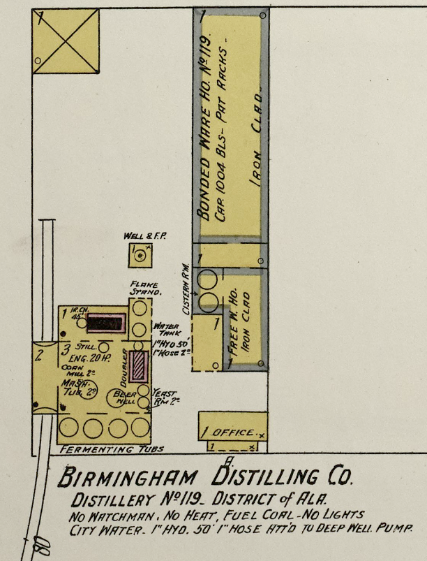
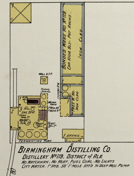
Detail from the 1902 Sanborn Fire Insurance Map of Birmingham, Jefferson County, Alabama, via the U.S. Library of Congress (link)
| Public Domain | |
| This work was published in the United States before 1928 and is now presumed to be in the public domain. | |
| Media Type: Map | |
| This is a map or part of a map, the design of which may be protected by copyright. | |
File history
Click on a date/time to view the file as it appeared at that time.
| Date/Time | Thumbnail | Dimensions | User | Comment | |
|---|---|---|---|---|---|
| current | 09:43, 10 May 2020 | | 612 × 803 (753 KB) | Dystopos (talk | contribs) | Detail from the 1902 Sanborn Fire Insurance Map of Birmingham, Jefferson County, Alabama, via the U.S. Library of Congress ([https://www.loc.gov/resource/g3974bm.g3974bm_g000151902/?sp=4&r=0.041,0.917,0.31,0.253,0 link]) {{PD}} {{Map}} |
You cannot overwrite this file.
File usage
The following page uses this file: