File:Birmingham On-Demand service area map.png
Jump to navigation
Jump to search
No higher resolution available.
Birmingham_On-Demand_service_area_map.png (750 × 574 pixels, file size: 482 KB, MIME type: image/png)
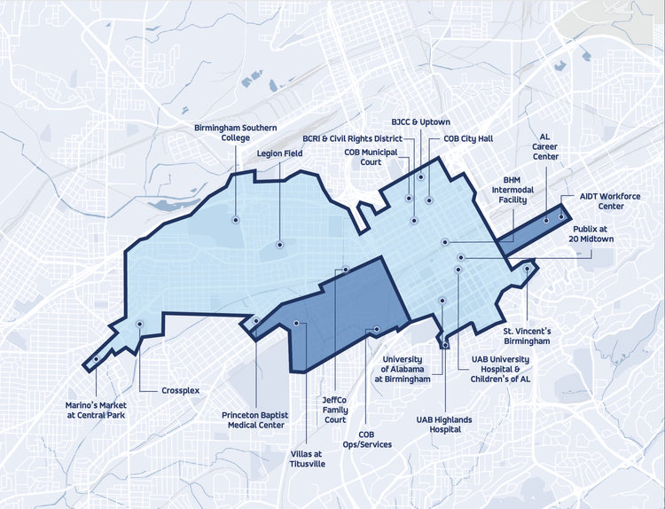
Service area map for Birmingham On-Demand microtransit program.
| Fair Use media | |
| This work is subject to copyright and/or trade mark protection. It is used here without express permission under the legal doctrine of Fair Use. Rights to the work remain the sole property of the creator. See Bhamwiki:Copyrights for further information. | |
| Media Type: Map | |
| This is a map or part of a map, the design of which may be protected by copyright. | |
File history
Click on a date/time to view the file as it appeared at that time.
| Date/Time | Thumbnail | Dimensions | User | Comment | |
|---|---|---|---|---|---|
| current | 09:33, 2 October 2022 | | 750 × 574 (482 KB) | Dystopos (talk | contribs) | |
| 17:40, 4 December 2019 | 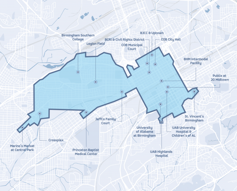 | 768 × 619 (565 KB) | Dystopos (talk | contribs) | Service area map for Birmingham On-Demand microtransit program. {{Fair Use}} {{Map}} |
You cannot overwrite this file.
File usage
The following page uses this file: