File:Ruffner 2 map.jpg: Difference between revisions
Jump to navigation
Jump to search
(Map of extant surface works at Ruffner No. 2 mine. Surveyed by Panamerican Consultants for the Historic American Engineering Record ([http://www.loc.gov/pictures/collection/hh/item/al0962/ HAER AL-27])) |
No edit summary |
||
| (One intermediate revision by the same user not shown) | |||
| Line 1: | Line 1: | ||
Map of extant surface works at [[Ruffner No. 2 mine]]. Surveyed by Panamerican Consultants for the Historic American Engineering Record ([http://www.loc.gov/pictures/collection/hh/item/al0962/ HAER AL-27]) | Map of extant surface works at [[Ruffner No. 2 mine]]. Surveyed by Panamerican Consultants for the Historic American Engineering Record ([http://www.loc.gov/pictures/collection/hh/item/al0962/ HAER AL-27]) | ||
==Licensing== | |||
{{HAER}} | |||
Latest revision as of 15:56, 5 January 2024
Map of extant surface works at Ruffner No. 2 mine. Surveyed by Panamerican Consultants for the Historic American Engineering Record (HAER AL-27)
Licensing
| Historic American Engineering Record | |
| This work was created for the United States Government and is part of the public domain. | |
File history
Click on a date/time to view the file as it appeared at that time.
| Date/Time | Thumbnail | Dimensions | User | Comment | |
|---|---|---|---|---|---|
| current | 10:20, 8 February 2012 | 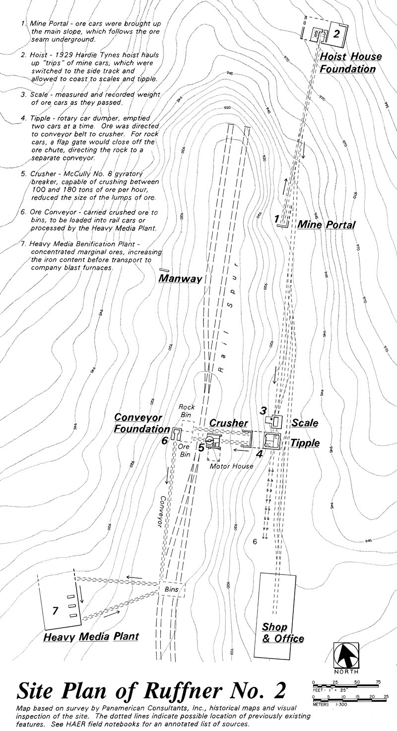 | 800 × 1,472 (262 KB) | Dystopos (talk | contribs) | Map of extant surface works at Ruffner No. 2 mine. Surveyed by Panamerican Consultants for the Historic American Engineering Record ([http://www.loc.gov/pictures/collection/hh/item/al0962/ HAER AL-27]) |
You cannot overwrite this file.
File usage
The following page uses this file: