File:Smith's Park 1898.jpg: Difference between revisions
Jump to navigation
Jump to search
([{Smith's Park]], as seen in a detail from George F. Cram (1898) ''Cram's Universal Atlas, Geographical, Astronomical and Historical''. Chicago via the University of Alabama Historical Map Archive ([http://alabamamaps.ua.edu/historicalmaps/counties/jeffer) |
No edit summary |
||
| (One intermediate revision by the same user not shown) | |||
| Line 1: | Line 1: | ||
[ | [[Smith's Park]], as seen in a detail from George F. Cram (1898) ''Cram's Universal Atlas, Geographical, Astronomical and Historical''. Chicago via the University of Alabama Historical Map Archive ([http://alabamamaps.ua.edu/historicalmaps/counties/jefferson/jefferson.html link]) | ||
{{PD}} | {{PD}} | ||
{{Map}} | |||
Latest revision as of 11:02, 8 January 2016
Smith's Park, as seen in a detail from George F. Cram (1898) Cram's Universal Atlas, Geographical, Astronomical and Historical. Chicago via the University of Alabama Historical Map Archive (link)
| Public Domain | |
| This work was published in the United States before 1928 and is now presumed to be in the public domain. | |
| Media Type: Map | |
| This is a map or part of a map, the design of which may be protected by copyright. | |
File history
Click on a date/time to view the file as it appeared at that time.
| Date/Time | Thumbnail | Dimensions | User | Comment | |
|---|---|---|---|---|---|
| current | 16:55, 16 March 2014 | 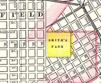 | 400 × 328 (97 KB) | Dystopos (talk | contribs) | [{Smith's Park]], as seen in a detail from George F. Cram (1898) ''Cram's Universal Atlas, Geographical, Astronomical and Historical''. Chicago via the University of Alabama Historical Map Archive ([http://alabamamaps.ua.edu/historicalmaps/counties/jeffer |
You cannot overwrite this file.
File usage
The following page uses this file: