File:Map of Stouts Road in northern Jefferson County.jpg
Jump to navigation
Jump to search
Size of this preview: 80 × 596 pixels. Other resolution: 278 × 2,070 pixels.
Original file (278 × 2,070 pixels, file size: 379 KB, MIME type: image/jpeg)
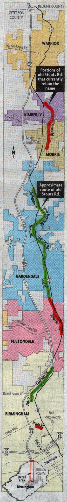
Map of Stouts Road from an article that appeared in the Birmingham News on July 23, 2008.
File history
Click on a date/time to view the file as it appeared at that time.
| Date/Time | Thumbnail | Dimensions | User | Comment | |
|---|---|---|---|---|---|
| current | 20:45, 27 January 2018 | 278 × 2,070 (379 KB) | Robert Matthews (talk | contribs) | Map of Stouts Road from an article that appeared in the Birmingham News on July 23, 2008. {{Fair use}} |
You cannot overwrite this file.
File usage
The following page uses this file: