File:1948 Camp Fletcher map.png
Jump to navigation
Jump to search

Size of this preview: 282 × 598 pixels. Other resolution: 373 × 791 pixels.
Original file (373 × 791 pixels, file size: 70 KB, MIME type: image/png)
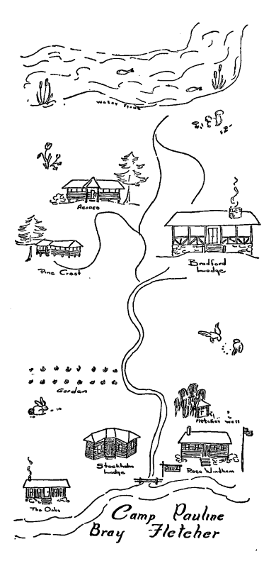
1940s map of Camp Fletcher, printed in Carrie E. Watts (August 1, 1948) "History and development of Camp Pauline Bray Fletcher, Bessemer, Alabama, with emphasis on the 1947 program" Master's Thesis, Atlanta University School of Social Work. ETD Collection for AUC Robert W. Woodruff Library. Paper 704.
| Fair Use media | |
| This work is subject to copyright and/or trade mark protection. It is used here without express permission under the legal doctrine of Fair Use. Rights to the work remain the sole property of the creator. See Bhamwiki:Copyrights for further information. | |
| Media Type: Map | |
| This is a map or part of a map, the design of which may be protected by copyright. | |
File history
Click on a date/time to view the file as it appeared at that time.
| Date/Time | Thumbnail | Dimensions | User | Comment | |
|---|---|---|---|---|---|
| current | 14:24, 14 October 2016 | | 373 × 791 (70 KB) | Dystopos (talk | contribs) | 1940s map of Camp Fletcher, printed in Carrie E. Watts (August 1, 1948) "[http://digitalcommons.auctr.edu/cgi/viewcontent.cgi?article=2242&context=dissertations History and development of Camp Pauline Bray Fletcher, Bessemer, Alabama, with emphasis... |
You cannot overwrite this file.
File usage
The following page uses this file: