File:Alabama minerals.png
Jump to navigation
Jump to search

Size of this preview: 387 × 600 pixels. Other resolution: 516 × 800 pixels.
Original file (516 × 800 pixels, file size: 165 KB, MIME type: image/png)
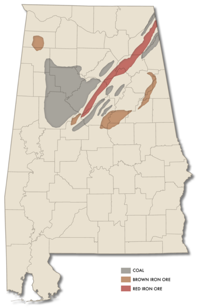
Map showing coal and iron ore resources in Alabama.
Map created by User:Dystopos using an .SVG map of Alabama counties from Wikimedia commons and a map of mineral resources included as part of the documentation of the "Birmingham District Railroads, Birmingham vicinity, Jefferson County, AL" for the Historic American Engineering Record. (Nichole N. Duren, 1992)
File history
Click on a date/time to view the file as it appeared at that time.
| Date/Time | Thumbnail | Dimensions | User | Comment | |
|---|---|---|---|---|---|
| current | 23:13, 9 September 2007 | | 516 × 800 (165 KB) | Dystopos (talk | contribs) | Map showing coal and iron ore resources in Alabama. Map created by User:Dystopos using an .SVG map of Alabama counties from Wikimedia commons and a map of mineral resources included as part of the documentation of the "[http://hdl.loc.gov/loc.pnp/hhh.al0 |
You cannot overwrite this file.
File usage
The following 2 pages use this file: