Cordova
| City of Cordova | |
| Incorporated | 1859 |
|---|---|
| Population | 2,035 |
| Mayor | Jack Scott |
| School district | Walker County Schools |
| Government |
Cordova City Council |
| Web site | walkercounty.us/cordova |

| |
| Locate with Google Maps | |
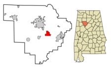
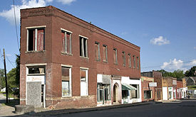
Cordova is a city of 2,035 on 5.9 square miles near the banks of the Mulberry Fork in Walker County. The city is governed by a Mayor (Jack Scott) and 7-member Cordova City Council. Cordova City Hall is located at 74 Main Street. Cordova's ZIP code is 35550.
The community was first settled around 1822 and was originally called "Dent" or "Dent's Place". Captain Benjamin Long renamed the settlement in 1859 for Córdoba, Mexico, where he had been stationed during the Mexican War. He opened a mercantile in the community and took charge of recruiting other businesses. The Nashua Manufacturing Company of New Hampshire built the Indian Head Textile Mills in Cordova in 1890, boosting its population as families came to the town for employment. The company constructed housing for its workers and provided many other facilities common to mill towns, including the Indian Head School (now the site of the Cordova Health and Rehabilitation Center). The Burlington Northern & Santa Fe and Norfolk Southern Railway subsequently connected Cordova to the outside world.
The closing of the mill in the 1950s diminished the town's prospects, with hopes pinned on new development following the completion of I-22 through the county. Currently, Cordova's major employer is the military contractor BAE Systems.
Cordova was struck by an F3 tornado on April 24, 2010.
Education
Cordova is home to Cordova Elementary School, Bankhead Middle School and Cordova High School in the Walker County Schools system.
Demographics
As of the census of 2010, there were 2,095 people residing in the city's 842 occupied housing units, for an average household of 2.5 persons. The population density was 349.0 people per square mile, with housing units at an average density of 173.4 per square mile. The racial makeup of the city was 83.4% white and 14.5% African American, with 0.7% of the population (15 people) Hispanic or Latino of any race.
In 2000, there were 1,009 households out of which 28.8% had children under the age of 18 living with them, 43.3% were married couples living together, 18.5% had a female householder with no husband present, and 34.0% were non-families. 31.4% of all households were made up of individuals and 17.0% had someone living alone who was 65 years of age or older.
In the city the population was spread out with 23.2% under the age of 18, 7.4% from 18 to 24, 24.4% from 25 to 44, 22.0% from 45 to 64, and 23.1% who were 65 years of age or older. The median age was 41 years. For every 100 females there were 79.1 males. For every 100 females age 18 and over, there were 74.2 males.
The median income for a household in the city was $17,389, and the median income for a family was $24,896. Males had a median income of $32,353 versus $19,549 for females. The per capita income for the city was $11,489. About 25.6% of families and 26.0% of the population were below the poverty line, including 30.4% of those under age 18 and 14.9% of those age 65 or over.
Notable residents
- Jeran Akers, mayor of Plano, Texas
- Doyle Alexander, baseball player
References
- Foscue, Virginia O. (1989) Place Names in Alabama. Tuscaloosa: University of Alabama Press. ISBN 081730410X
- Alabama League of Municipalities, Municipal Directory" - accessed March 7, 2011
| Walker County | |
|---|---|
| Topics | |
| Cities |
Carbon Hill | Cordova | Curry | Dora | Eldridge | Jasper (seat) | Kansas | Nauvoo | Oakman | Parrish | Sipsey | Sumiton |
