William Barker residence: Difference between revisions
Jump to navigation
Jump to search
mNo edit summary |
m (Copy and paste errors.) |
||
| Line 6: | Line 6: | ||
* Carter, Lane (February 1954) "[http://www.birminghamrewound.com/features/Norwood%20%2802-54%29.jpg Historic Norwood home being razed]." {{BN}} - via [[Birmingham Rewound]] | * Carter, Lane (February 1954) "[http://www.birminghamrewound.com/features/Norwood%20%2802-54%29.jpg Historic Norwood home being razed]." {{BN}} - via [[Birmingham Rewound]] | ||
{{DEFAULTSORT:Barker residence}} | |||
{{DEFAULTSORT: | |||
[[Category:Houses]] | [[Category:Houses]] | ||
[[Category:29th Street North]] | [[Category:29th Street North]] | ||
Revision as of 10:04, 19 February 2014
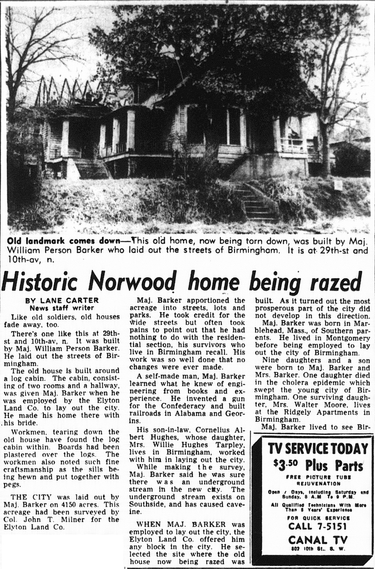
The William Barker residence was a historic house built by Major William Barker at the corner of 29th Street and 10th Avenue North just south of the area later developed as Norwood.
Barker, a civil engineer who laid out Birmingham's original lot lines for the Elyton Land Company according to John Milner's plat, selected the block on which he constructed the house as part of his payment. His original two-room dogtrot log cabin was incorporated into the expanded frame house which stood until 1954.
References
- Carter, Lane (February 1954) "Historic Norwood home being razed." The Birmingham News - via Birmingham Rewound