Main Street (Trussville): Difference between revisions
Jump to navigation
Jump to search
| Line 53: | Line 53: | ||
*** 455: [[Dollar Tree]], former location of [[Rite Aid]] | *** 455: [[Dollar Tree]], former location of [[Rite Aid]] | ||
*** 465: [[Winn-Dixie]] | *** 465: [[Winn-Dixie]] | ||
** [[Park at Hamilton Place]] | |||
* Highland Circle intersection (continues south-west as Gadsden Highway) | * Highland Circle intersection (continues south-west as Gadsden Highway) | ||
[[Category:Main Street Trussville|*]] | [[Category:Main Street Trussville|*]] | ||
Revision as of 11:58, 19 January 2021
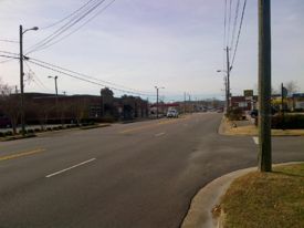
Main Street is the name for U. S. Highway 11 as it passes through downtown Trussville. While Highway 11 is a north-south highway, Main Street is mostly an east-west road and is one of the primary thoroughfares through the city.
Traveling north-eastward from I-459, street signs indicate Highway 11 as "Main Street" beginning after Mary Taylor Road, however, postal addresses for Main Street do not begin until after Highland Circle at the Trussville Marketplace shopping center.
Notable locations
- Cahaba River bridge (continues north-east as Gadsden Highway)
- Parkway Drive intersection
- Trussville Civitan Park
- 131: Trussville Police Department, City Hall
- 137: Bryant Bank, former location of Trussville Motors
- 156: Former location of Sticks 'N' Stuff
- 158: Edgar's Bakery & Café
- 163: Moe's Original BBQ, formerly Legends Smokehouse, Willy T's, Arby's, Jack's Hamburgers
- 169: former location of LaJara
- 180: Team Car Wash
- 183: Cahaba Cycles, Jevia Green Earth Salon, M. P. Dawson's Mercantile
- 193: Regions Bank
- Chalkville Road intersection
- 200: Braden's Furniture, former location of The Wharf, Norrell's, Glenn Five & Dime
- 201: The Straw Hat, former location of Fox's Pizza Den, Domino's Pizza
- 206: former location of Mary's Bouquet (1974–2020)
- 209: The Three Earred Rabbit (2009–)
- 218: Former location of Honey & Spice Health Foods, CAC's Gourmet Deli, Café on Main (2000–2016)
- 220: Half Shell Oyster House, former location of Western Supermarket and Dollar General
- 219: Former location of Mabe Power Equipment
- 224: Guitar FX, former location of The Adventure Store (Jack Smith 1993), Ta Tumble U
- 226: former location of Ginni G Florist, former Post Office
- 227: Slag Heap Brewery, former location of an ice plant, Japan International Karate Do Academy
- 229: Mike & Mike's Complete Auto Care, former location of Sinclair, Hi-Fi Autosound & Security
- 233: Shirley's Flowers & Events, former location of The Frequent Flower
- 305: Union State Bank
- 306: former location of Trussville Auto & Truck (1979–December 2020)
- 308: Sonic Drive-In
- 312: Rodney Scott's Whole Hog BBQ, former location of Joel's Restaurant
- 314: Hero Doughnuts and Buns
- Village at Trussville
- 305: Union State Bank
- 307: 24e Fitness
- 309: Fresh Value Marketplace, formerly Food World
- 315: CVS Pharmacy, former location of Big B Drugs
- Watterson Parkway intersection
- 322: Anytime Fitness
- 407: Captain D's
- 410: Stray Cats Home Decor (2020–)
- Trussville Marketplace
- 419: Regions Bank
- 425: Express Oil Change
- 445: Parkway Cleaners
- 445: Magic City Computers, former location of BellSouth Mobility
- 445: Domino's Pizza
- 445 Suite 121: Thai Basil & Sushi, former location of Sneaky Pete's, Miceli's Italian Food
- 455: Dollar Tree, former location of Rite Aid
- 465: Winn-Dixie
- Park at Hamilton Place
- Highland Circle intersection (continues south-west as Gadsden Highway)
