File list
Jump to navigation
Jump to search
This special page shows all uploaded files.
| Date | Name | Thumbnail | Size | User | Description | Versions |
|---|---|---|---|---|---|---|
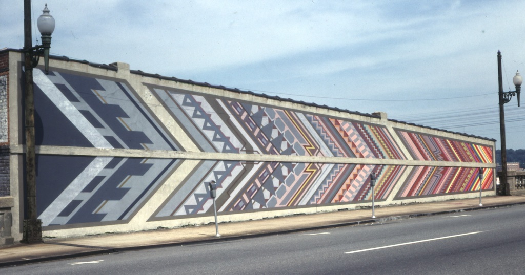
| 13:37, 13 November 2023 | "Geo-Chromatic Progress" (photo by Ron Taylor).jpeg (file) | .jpeg) |
192 KB | Mark Taylor | "Geo-Chromatic Progress" (1978) by Michael Mojher on the 22nd Street Viaduct. Photographed September 20, 1979 by Ron Taylor | 1 |
| 16:09, 4 October 2021 | 1000Bulbs 500 logo.png (file) | 86 KB | Dystopos | Logo for the 1000Bulbs.com 500 at Talladega Superspeedway {{Fair Use}} {{Logo}} | 1 | |
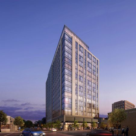
| 13:38, 8 January 2019 | 1001 20th Street South rendering.jpg (file) |  |
30 KB | Dystopos | Rendering by Myefski Architects of the 1101 20th Street South student apartment tower. {{Fair Use}} {{Rendering}} | 1 |
| 00:28, 13 March 2011 | 103.1 The Vulcan logo.jpg (file) | 14 KB | Dystopos | Logo for WERC FM 103.1 "The Vulcan" {{Fair use-Logo}} | 1 | |
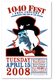
| 19:21, 15 April 2008 | 1040 Fest 2008 poster.jpg (file) |  |
58 KB | Dystopos | Poster for 1040 Fest 2008. {{Fair use-Ad}} | 1 |
| 09:40, 6 December 2006 | 105.5 The Vulcan logo.PNG (file) | 20 KB | Dystopos | Logo for WENN FM 105.5 "The Vulcan" {{Fair use-Logo}} | 1 | |
| 20:40, 17 July 2009 | 106th Reconnaissance Squadron.jpg (file) |  |
85 KB | Dystopos | Insignia of the 106th Reconaissance Squadron {{Fair use-Logo}} | 1 |
| 23:53, 28 November 2006 | 107.7 the X.jpg (file) |  |
10 KB | Dystopos | Logo for 107.7 the X (WRAX) {{Fair use-Logo}} | 1 |
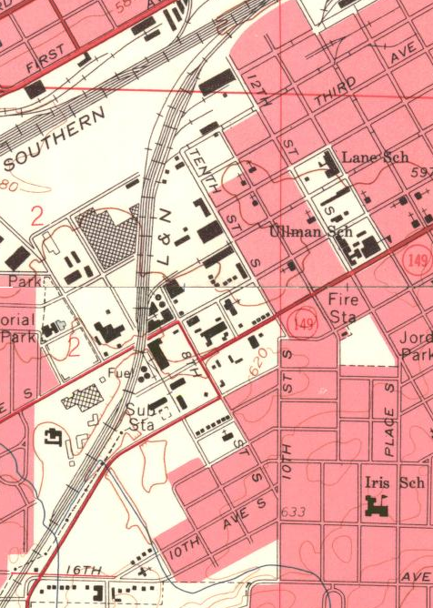
| 12:49, 19 February 2014 | 10th Street South 1959.png (file) |  |
676 KB | Lkseitz | Map of 10th Street South published in 1959. {{PD-Gov}}{{USGS}} | 1 |
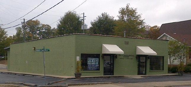
| 22:10, 31 October 2013 | 110 North Chalkville Road.JPG (file) |  |
33 KB | Wheresdib | 110 North Chalkville Road, taken October 31, 2013 by User:Wheresdib. {{Permission}} | 1 |
| 19:42, 24 May 2006 | 117th ARW patch.jpg (file) |  |
12 KB | Dystopos | Patch of the 117th Air Refueling Wing | 1 |
| 10:24, 19 January 2010 | 119 20th St N 2009.JPG (file) |  |
29 KB | Cstrahan | 1 | |
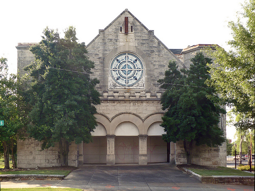
| 21:41, 25 June 2009 | 11th Avenue Methodist Church.jpg (file) |  |
156 KB | Dystopos | Front of the vacant 11th Avenue Methodist Church in Southside. Photographed June 23, 2009 by User:Dystopos {{CC Image}} | 1 |
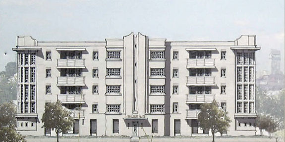
| 20:53, 6 April 2016 | 11th Court Flats rendering.jpg (file) |  |
71 KB | Dystopos | Rendering of 11th Court Flats proposal by Dungan Nequette Architects, from a sign posted on site ([http://www.flickr.com/photos/dystopos/96618331/ photo]). Photographed by User:Dystopos {{Fair Use}} {{Rendering}} | 1 |
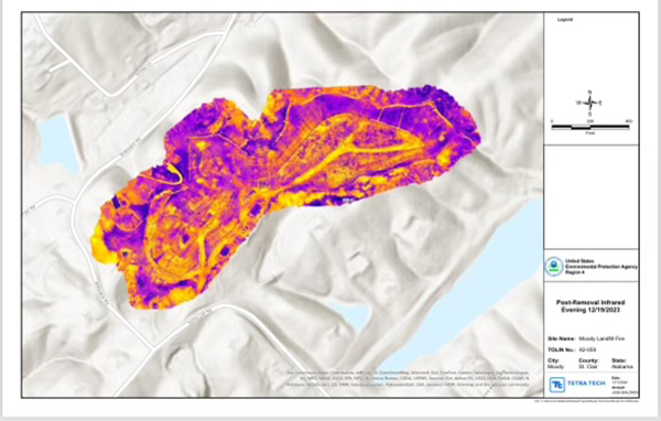
| 17:34, 5 February 2024 | 12-23 Moody landfill thermograph.jpg (file) |  |
162 KB | Dystopos | A December 19, 2024 aerial thermographic survey of the Moody landfill fire showing persisting underground hotspots. From Lee Hedgepeth (February 2, 2024) "[https://insideclimatenews.org/news/02022024/alabama-underground-landfill-fire-still-burning-may-never-be-extinguished/ Will the Moody Landfill Fire Ever Be Extinguished? The EPA Isn’t So Sure]." ''Inside Climate News'' | 1 |
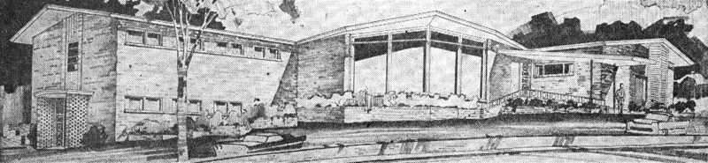
| 11:17, 19 April 2015 | 1211 27th Pl S.jpg (file) | 151 KB | Dystopos | 1959 rendering by Greer, Holmquist & Chambers of the professional office building at 1211 27th Place South. ([http://server16044.contentdm.oclc.org/u?/p4017coll2,1235 link]) {{Fair Use}} {{Rendering}} | 1 | |
| 16:27, 11 November 2012 | 121st ARCOM patch.jpg (file) |  |
99 KB | Dystopos | Insignia of the 121st Army Reserve Command {{Fair Use}} {{Patch}} | 1 |
| 16:44, 12 November 2020 | 125015871 2681017442211048 354646985933970350 n.jpg (file) |  |
9 KB | BootstrapsRiley | 1 | |
| 10:12, 28 October 2022 | 13-17 Office Park Circle 3-d view.jpg (file) |  |
235 KB | Dystopos | View of 13-17 Office Park Circle, from Google Maps {{Gmap}} | 1 |
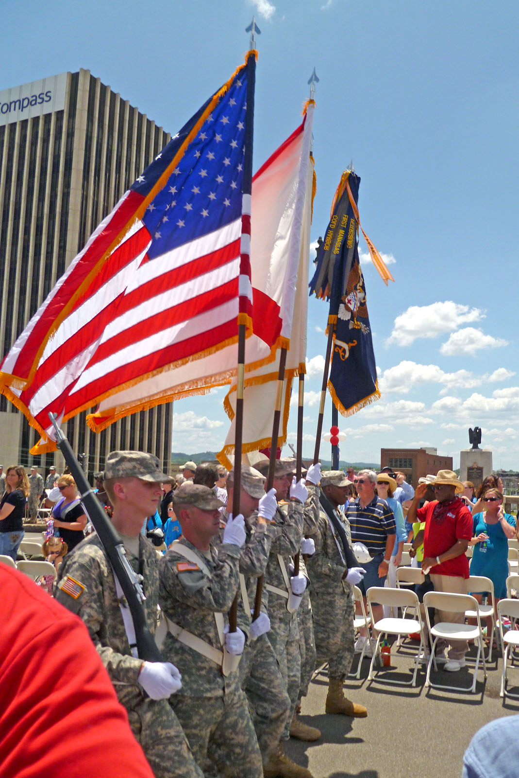
| 19:56, 28 May 2012 | 167th Alabama colors.jpg (file) |  |
342 KB | Dystopos | Colors of the 167th Theater Sustainment Command during the rededication of the Rainbow Viaduct in Birmingham on May 28, 2012. Photo by User:Dystopos {{CC Image}} | 1 |
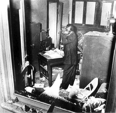
| 11:01, 25 January 2008 | 16th St BC bombed office 1963.jpg (file) |  |
132 KB | Dystopos | Photograph taken after the 1963 church bombing at the 16th Street Baptist Church. Courtesy Birmingham Public Library Archives. Item number 85.1.10 in the Alabama v. Chambliss Trial Transcript collection at the [[Birmingham Public Library Archives | 1 |
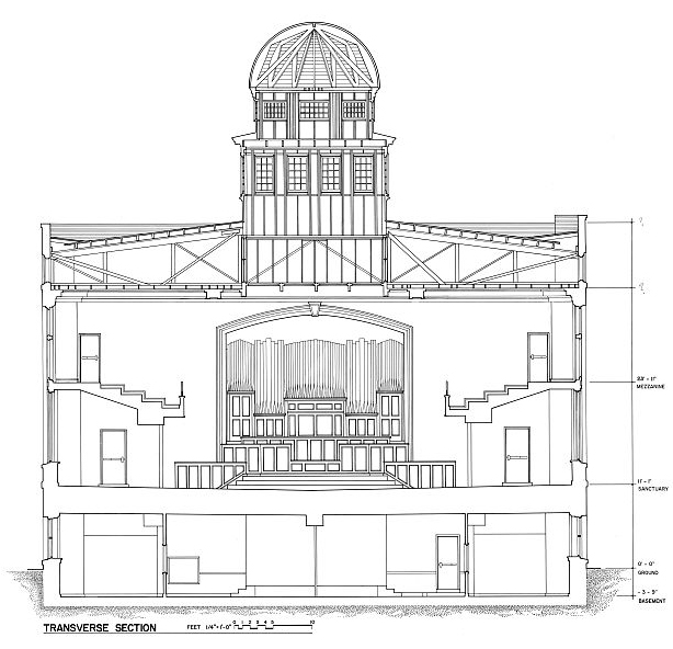
| 15:09, 29 December 2013 | 16th St Baptist section.jpg (file) |  |
169 KB | Dystopos | Transverse section through 16th Street Baptist Church from the Historic American Buildings Survey, HABS ALA,37-BIRM,33- (sheet 12 of 16) ([http://hdl.loc.gov/loc.pnp/hhh.al0966/sheet.00012a link]) {{PD-Gov}} | 1 |
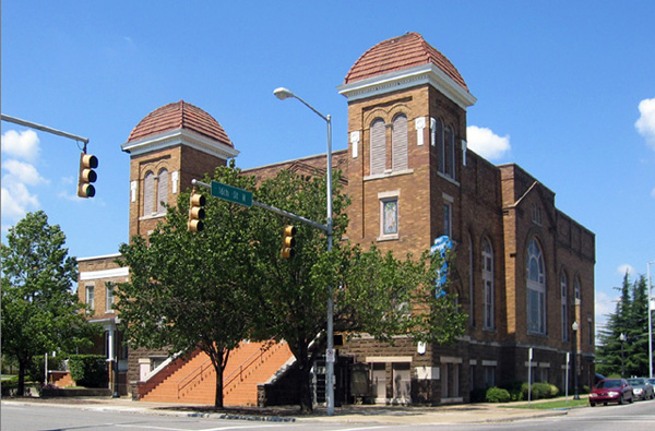
| 23:42, 21 March 2006 | 16th Street Baptist Church.JPG (file) |  |
147 KB | Dystopos | 16th Street Baptist Church. 16th Street North & 6th Avenue North. Wallace Rayfield, 1911. | 1 |
| 15:34, 6 March 2011 | 16th Street Baptist sign.jpg (file) |  |
60 KB | Dystopos | The neon sign at 16th Street Baptist Church. Photographed February 25, 2010 by Carol M. Highsmith and released to the public domain through her donation to the George F. Landegger Collection of Alabama Photographs in Carol M. Highsmith's America, Libr | 1 |
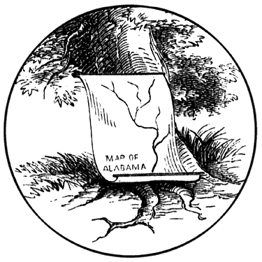
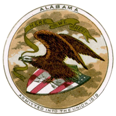
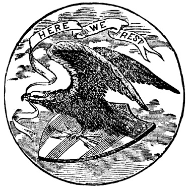
| 22:46, 27 February 2011 | 1817 Alabama seal.png (file) |  |
52 KB | Dystopos | Depiction of 1817 Seal of Alabama {{Seal}} | 1 |
| 23:29, 27 February 2011 | 1817 Alabama seal 20.png (file) |  |
172 KB | Dystopos | Version of the Seal of Alabama on Confederate currency issued by the state. {{Seal}} | 1 |
| 00:21, 1 March 2011 | 1817 Alabama seal WPA.png (file) |  |
211 KB | Dystopos | 1817 Seal of Alabama, as depicted in "Flags, Seals, and Coat of Arms of Alabama" (1941) Visual Education Project. Birmingham: Works Projects Administration of Alabama. Typescript from the Birmingham Public Library Digital Collections. ([http://bplonl | 1 |
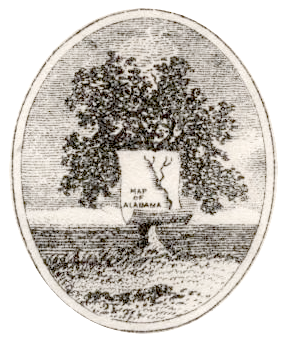
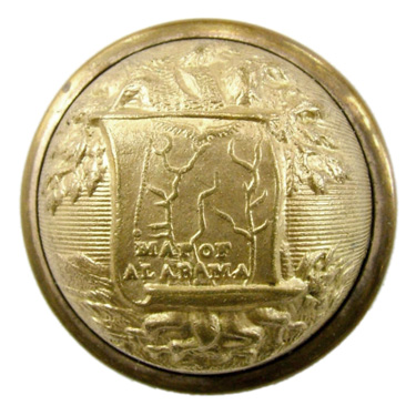
| 22:15, 27 February 2011 | 1817 Alabama seal button.jpg (file) |  |
86 KB | Dystopos | Original Seal of Alabama on a button manufactured c. 1860 by Schuyler H&G for officers uniforms of the Alabama State Militia. {{PD}} | 1 |
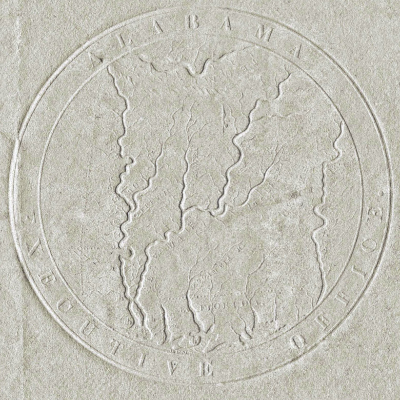
| 14:12, 27 March 2021 | 1818 Alabama Executive Office seal.jpg (file) |  |
254 KB | Dystopos | Enhanced and enlarged image of the 1818 Seal of Alabama engraved by Moritz Fürst to a design by Governor William Bibb. This imprint, the earliest known to survive, appears on a February 15, 1819 proclamation certifying Bibb's appointment of [[... | 1 |
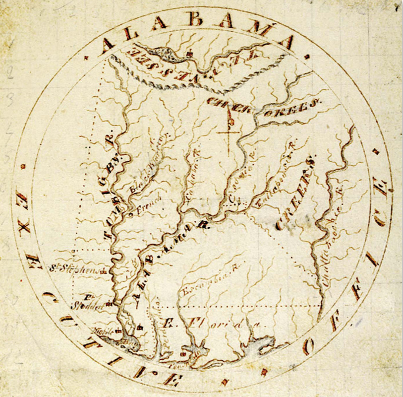
| 11:10, 27 March 2021 | 1818 Bibb illustration.jpg (file) |  |
330 KB | Dystopos | Illustration sent by William Bibb to Secretary of State John Quincy Adams and used by Moritz Fürst to produce the first Seal of Alabama in 1818 {{PD}} {{Seal}} | 1 |
| 15:46, 9 May 2016 | 1818 Tullavahajah map.PNG (file) |  |
1.61 MB | Dystopos | Detail of "Map of Alabama constructed from the surveys in the General Land Office and other documents." by John Melish (1818) showing Mud Town (Tullavahajah) on the Cahaba River. From "Historical Maps of Alabama: Before 1820" at alabamamaps.ua.... | 1 |
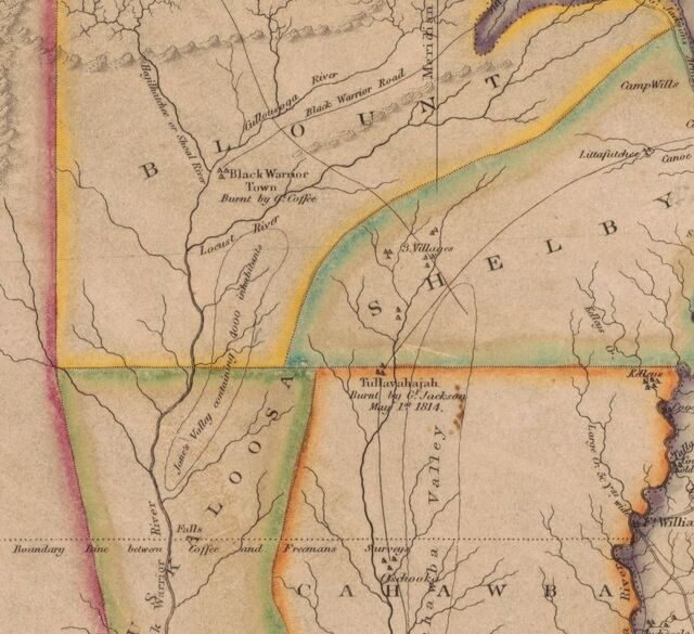
| 11:45, 23 August 2019 | 1819 Black Warrior Town map.jpg (file) |  |
81 KB | Dystopos | Detail from a "Map of Alabama constructed from the surveys in the General Land Office and other documents. Improved to 1819," by John Melish, published in Philadelphia in 1819. From the Library of Congress ([https://lccn.loc.gov/gm71005414 link]) | 1 |
| 16:41, 28 June 2023 | 1819 News logo.png (file) | 109 KB | Dystopos | Logo for 1819 News {{Fair Use}} {{Logo}} | 1 | |
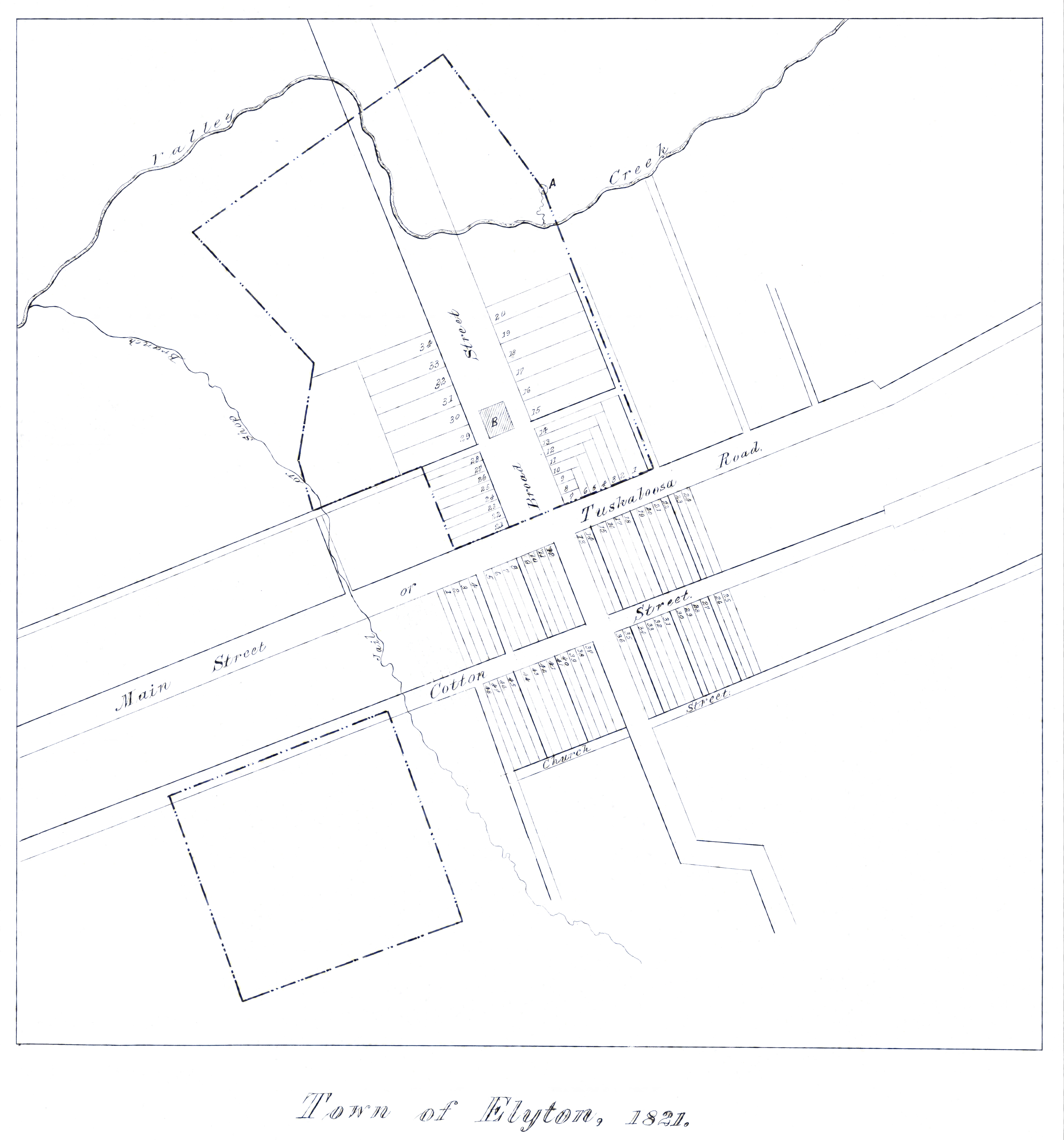
| 14:40, 3 October 2017 | 1821 Elyton map.jpg (file) | Error creating thumbnail: File with dimensions greater than 12.5 MP |
2.65 MB | Earthsound | larger resolution; cleaned up map from http://digital.archives.alabama.gov/cdm/ref/collection/maps/id/537 | 2 |
| 21:59, 5 May 2015 | 1847 Jefferson County Courthouse.jpg (file) |  |
344 KB | Dystopos | Birmingham View Company photo of the Jefferson County Courthouse (1847) in Elyton after the seat of government had been moved to Birmingham. The advertising poster is for Horse Shoe Plug Tobacco. From {{Cruikshank-1920}}, p. 158 {{PD}} | 1 |
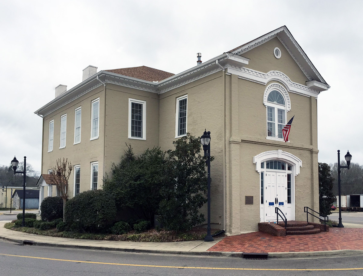
| 21:16, 13 January 2023 | 1854 Shelby County Courthouse.jpg (file) |  |
387 KB | Robert Matthews | 1854 Shelby County Courthouse. Photo by Robert Matthews. {{CC Image}} | 1 |
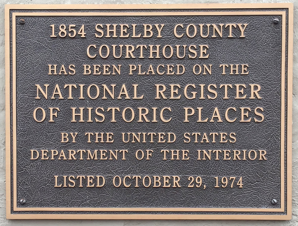
| 21:17, 13 January 2023 | 1854 Shelby County Courthouse plaque.jpg (file) |  |
417 KB | Robert Matthews | 1854 Shelby County Courthouse plaque denoting when the structure was added to the National Register of Historic Places. Photo by Robert Matthews. {{CC Image}} | 1 |
| 21:53, 27 February 2011 | 1868 Alabama seal.jpg (file) |  |
96 KB | Dystopos | The Seal of Alabama in use from 1868–1939 {{Seal}} | 1 |
| 01:08, 1 March 2011 | 1868 Alabama seal 1876.png (file) |  |
212 KB | Dystopos | 1868 Seal of Alabama as depicted in A.J. Connell's "Arms of the states and territories of the American union in 1876", lithograph housed at the Library of Congress ([http://hdl.loc.gov/loc.pnp/pga.00528 link]) {{PD}} | 1 |
| 22:47, 27 February 2011 | 1868 Alabama seal BW.jpg (file) |  |
114 KB | Dystopos | Engraved version of 1868 Seal of Alabama {{Seal}} | 1 |
| 00:24, 1 March 2011 | 1868 Alabama seal WPA.png (file) |  |
202 KB | Dystopos | 1868 Seal of Alabama, as depicted in "Flags, Seals, and Coat of Arms of Alabama" (1941) Visual Education Project. Birmingham: Works Projects Administration of Alabama. Typescript from the Birmingham Public Library Digital Collections. ([http://bplonl | 1 |
| 21:53, 27 February 2011 | 1868 Alabama seal variant.jpg (file) |  |
77 KB | Dystopos | Version of the Seal of Alabama in use from 1868–1939 {{Seal}} | 1 |
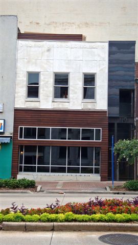
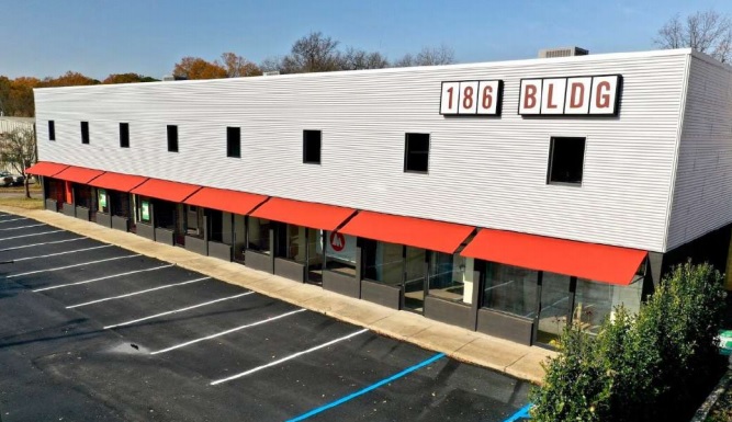
| 12:07, 29 September 2020 | 186 Building.jpg (file) |  |
98 KB | Dystopos | Photo of the remodeled 186 Building, from a Southpace marketing flyer. {{Fair Use}} {{Ad}} | 1 |
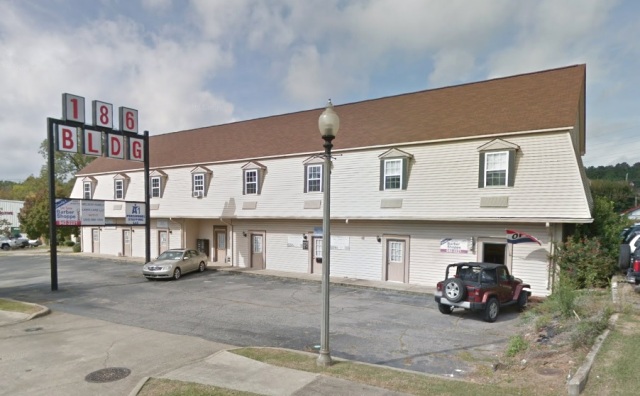
| 12:11, 29 September 2020 | 186 Building 2017.jpg (file) |  |
82 KB | Dystopos | Google Streetview image of the 186 Building in March 2017 {{Fair Use}} {{Gmap}} | 1 |
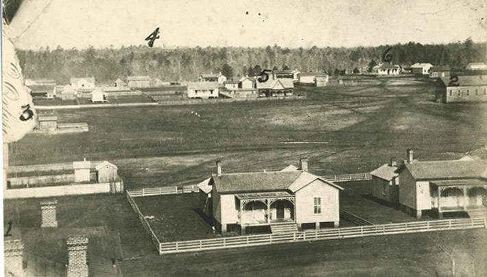
| 15:09, 1 September 2014 | 1870s Birmingham aerial.jpg (file) |  |
51 KB | Dystopos | 1 | |
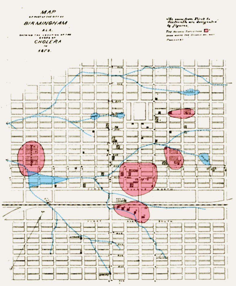
| 19:33, 18 January 2012 | 1873 cholera map color.jpg (file) |  |
206 KB | Dystopos | Map of the 1873 cholera epidemic. Compiled originally by Mortimer Jordan, Jr for inclusion in his 1875 report, published by the United States Government. Color added for Bhamwiki by User:Dystopos. The original map is in the public domain. {{CC Im | 1 |
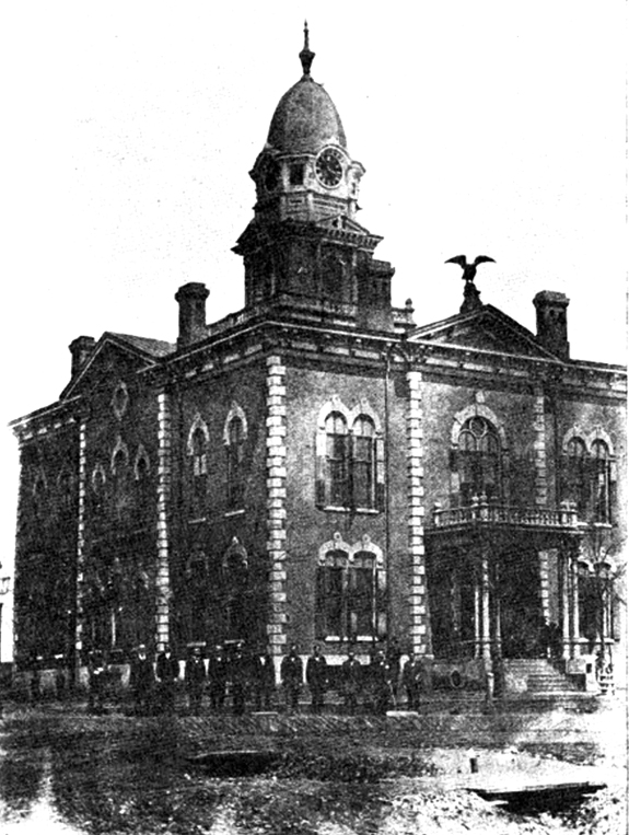
| 22:03, 5 May 2015 | 1875 Jefferson Counrty Courthouse.jpg (file) |  |
255 KB | Dystopos | The Jefferson County Courthouse (1875) from {{Cruikshank-1920}}, p. 160 {{PD}} | 1 |
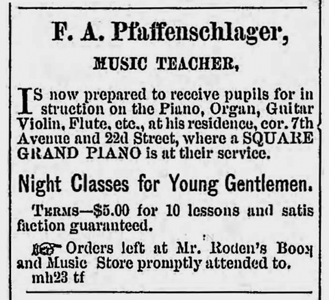
| 16:07, 15 October 2023 | 1881 Pfaffenschlaeger ad.png (file) |  |
119 KB | Dystopos | 1881 advertisement for Frank Pfaffenschlaeger {{Ad}} | 1 |
| 15:49, 24 May 2008 | 1884 16th Street Baptist.jpg (file) |  |
126 KB | Dystopos | 16th Street Baptist Church's 1884 building, as shown in Charles Octavius Boothe (1895) ''The Cyclopedia of the Colored Baptists of Alabama: Their Leaders and Their Work.'' Birmingham: Alabama Publishing Co. {{PD}} | 1 |
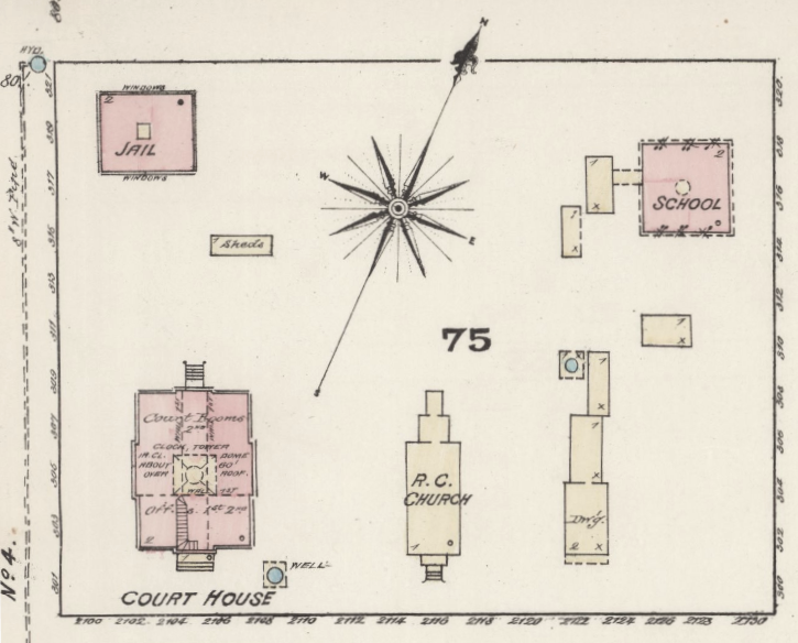
| 17:12, 17 May 2019 | 1885 Block 75 map.png (file) |  |
486 KB | Dystopos | Block 75 as it appeared in the 1885 Sanborn Map Company map book. ([http://www.loc.gov/resource/g3974bm.g3974bm_g000151885/?sp=3&r=-0.276,0.006,1.586,0.988,0 link]) {{PD}} | 1 |