Birmingham
| City of Birmingham | |

| |
| Incorporated | 1871 |
|---|---|
| Population | 196,910 (2022 est.) |
| Mayor | Randall Woodfin |
| School district | Birmingham City Schools |
| Government |
Birmingham City Council |
| Web site | birminghamal.gov |

| |
| Locate with Google Maps | |
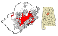
Birmingham (incorporated on December 19, 1871) is the fourth largest city in Alabama and the seat of Jefferson County (though portions of the city extend into Shelby County). The city was founded after the Civil War, as an industrial enterprise. It was named after Birmingham, the major industrial city of England.
Through the middle of the 20th century, Birmingham was the primary industrial center of the Southern United States. The astonishing pace of Birmingham's growth through the turn of the century, earned it the nicknames "Magic City" and "Pittsburgh of the South". Birmingham's major industries centered around iron and steel production. Over the course of the 20th century, while industry declined nationwide, the city's economy diversified. Though manufacturing is still a strong sector, Birmingham has also become a major medical research center and a regional banking and publishing power.
Home to a significant but rigorously segregated African-American middle class, Birmingham was one of the battlegrounds of the Civil Rights Movement throughout the 1960s. Race relations remain a central issue in Birmingham.
The population of the city proper was reported as 200,733 in the 2020 U.S. Census and estimated to have dropped to 196,910 in 2022. Those numbers represent a significant decline from the city's peak population of 340,887 in the 1960 census. Birmingham serves as the primary nucleus for a sprawling urbanization known as the Birmingham-Hoover Metropolitan Statistical Area with 1.12 million inhabitants.
History
Founding and early growth

Birmingham was founded in 1871 by the Elyton Land Company, a group of real estate promoters who sold lots near the planned crossing of the Alabama & Chattanooga and South & North Railroads. They made the original land purchase from William F. and Elizabeth Nabers on March 6 and opened an office for the public sale of lots in the new city on June 1.
The site of the railroad crossing was notable for the nearby deposits of iron ore, coal, and limestone — the three principal raw materials used in making steel. Birmingham is one of the very few places worldwide where significant amounts of all three minerals can be found in close proximity. From the start the new city was planned as a great center of industry. The founders borrowed the name of Birmingham — England's principal industrial city — to advertise that point. The new enterprise got off to a slow start. Shortly after a successful referendum to move the county seat from Elyton to Birmingham, growth of the city was impeded by an outbreak of cholera and a Wall Street crash in 1873. However, it began to grow shortly afterward at an explosive rate.
The turn of the century brought the substantial growth that gave Birmingham the nickname "The Magic City" as the downtown area developed from a low-rise commercial and residential district into a busy grid of neoclassical mid-rise and high-rise buildings and busy streetcar lines. Between 1902 and 1912, four large office buildings were constructed at the intersection of 20th Street North, the central north–south spine of the city, and 1st Avenue North, which connected the warehouses and industrial facilities stretching along the east–west railroad corridor. This impressive group of early skyscrapers was nicknamed "The Heaviest Corner on Earth".
Also helping Birmingham's growth was a successful annexation campaign that saw the town of Elyton and several other surrounding towns absorbed into the city in 1910. The result was an increase in the city's area from 3 to 48 square miles and a more than doubling of the population. Effective the year of a census, it caused the city to see a 245% growth rate over the 1900 census.
The Great Depression hit Birmingham especially hard as sources of capital that were fueling the city's growth rapidly dried up at the same time that farm laborers, driven off the land, made their way to the city in search of work. New Deal programs made important contributions to the city's infrastructure and artistic legacy, including such key improvements as Vulcan's tower and Oak Mountain State Park.
The wartime demand for steel and the post-war building boom gave Birmingham a rapid return to prosperity. Manufacturing diversified beyond the production of raw materials and major civic institutions such as schools, parks and museums, were able to expand their scope.
Birmingham civil rights movement
In the 1950s and '60s Birmingham received national and international attention as a center of the Civil rights movement. Locally the movement's activists were led by Fred Shuttlesworth, a fiery preacher who became legendary for his fearlessness in the face of violence, notably a string of racially motivated bombings that earned Birmingham the derisive nickname "Bombingham". A watershed in that movement occurred in 1963 when Martin Luther King Jr, imprisoned for having taken part in a nonviolent protest, wrote the now famous Letter from Birmingham Jail, a defining treatise in his cause against segregation. Birmingham is more remembered, however, for a bombing which occurred later that year. Four black girls were killed by a bomb planted at the 16th Street Baptist Church.
Recent history
In the 1970s urban renewal efforts focused around the development of the University of Alabama at Birmingham, which developed into a major medical and research center. In 1971 Birmingham celebrated its centennial with a round of public works improvements, including the upgrading of Vulcan Park. Birmingham's banking institutions enjoyed considerable growth as well and new skyscrapers started to appear in the city center for the first time since the 1920s. These projects helped the city's economy to diversify, but did not prevent the exodus of many of the city's residents to independent suburbs. In 1979 Birmingham elected Richard Arrington as its first African-American mayor.
Arrington continued an annexation policy first laid out by his predecessor, David Vann, which added large tracts of undeveloped land along with several small unincorporated communities to Birmingham's footprint. Through the "long lasso" legal doctrine, the city added far-flung parcels in Birmingport. Oxmoor Valley and Mount Olive, as well as along the U.S. Highway 280 corridor, resulting in the city's present irregular geographical shape.
The population inside Birmingham's city limits has fallen over the past few decades, due in large part to "white flight" from the city of Birmingham proper to surrounding suburbs. From 340,887 in 1960, the population was down to 242,820 in 2000, a loss of about 29 percent. The 2020 Census estimate listed Birmingham's population at 209,400. That same period saw a corresponding rise in the populations of the suburban communities of Hoover, Vestavia Hills, Alabaster, and Gardendale, none of which were incorporated as municipalities until after 1950.
Today, downtown Birmingham has begun to experience a bit of a rebirth. Money has been invested in reconstructing the city center into a 24-hour mixed-use district. The market for downtown lofts and condominiums mushroomed until the Great Recession while restaurant, retail and cultural options began to sprout up.
Geography and Climate
Geography

Birmingham is located at 33°31'29" North, 86°48'46" West (33.524755, -86.812740)
Birmingham occupies Jones Valley, flanked by long parallel mountain ridges (the tailing ends of the Appalachian foothills) running from north-east to south-west. The valley is drained by small creeks (Village Creek, Valley Creek) which flow into the Black Warrior River. More importantly, the valley was bisected by the principal railroad corridor, along which most of the early manufacturing operations began.
Red Mountain lies immediately south of downtown. Birmingham's television and radio broadcast towers are lined up along this prominent ridge. The "Over the Mountain" area, including Shades Valley, Shades Mountain and beyond, was largely shielded from the industrial smoke and rough streets of the industrial city. This is the setting for Birmingham's more affluent suburbs of Mountain Brook, Homewood, Vestavia Hills, and Hoover. South of Shades Valley is the Cahaba River basin.
Sand Mountain, a smaller ridge, flanks the city to the north and divides Jones Valley from much more rugged land to the north. The Louisville and Nashville Railroad (now CSX Transportation) enters the valley through Boyles Gap, a prominent gap in the long low ridge.
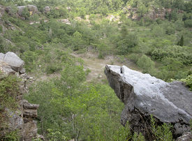
Ruffner Mountain, located due east of the heart of the city, is home to Ruffner Mountain Nature Preserve, one of the largest urban nature reserves in the United States.
According to the U.S. Census Bureau (2010), the city has a total area of 148.61 mi². 146.07 mi² of it is land and 2.54 mi² (1.71%) of it is water.
Climate
Birmingham has a temperate climate characterized by warm summers, mild winters, and abundant rainfall. Birmingham has slightly less rainfall than the Gulf Coast and is slightly cooler. January sees average daily high temperatures of 53.0 °F (11.7 °C) and lows of 31.8 °F (−0.1 °C). In July the average daily high is 90.6 °F (32.6 °C) and the low is 69.2 °F (20.7 °C). The average annual temperature in Birmingham is 62 °F (17 °C). The all-time record low is -10 °F (-23.3 °C), recorded on February 13, 1899, while the record high is 107 °F (41.7 °C), recorded on July 29, 1930. Snowfall is infrequent in the area, with a yearly average of only 0.5 inches (1 cm). The average yearly rainfall in Birmingham is about 52 inches (1330 mm), with March being the wettest month and October the driest.
The spring and fall months are pleasant but variable, but cold fronts frequently bring strong to severe thunderstorms and occasional tornadoes to the South. The fall season features less rainfall and fewer storms, as well as lower humidity than the spring, but it is also a secondary severe weather season. Birmingham is located on the heart of a tornado alley known as the Dixie Alley due to the frequency of tornadoes in Central Alabama. In late summer and fall months, Birmingham experiences occasional tropical storms and hurricanes due to its proximity to the Central Gulf Coast.
Government
Birmingham has a strong-mayor variant mayor-council form of government, led by a mayor and a nine-member city council. The current system replaced the previous city commission government in 1962 (primarily as a way to remove Commissioner of Public Safety Eugene "Bull" Connor from power).
According to the Mayor-Council Act of 1955, an issue before a city council must be approved by at least four votes with a quorum of at least five members present. The Mayor' signatures is not required for passage of an ordinace, but the Mayor may veto a measure by submitting an objection in writing. A two-thirds majority of the council is required to override such a veto.
Executive powers are held entirely by the mayor's office. The current mayor of Birmingham is Randall Woodfin, who successfully challenged incumbent William Bell in the 2017 Birmingham municipal election.
Economy
In the 1970s and 1980s, Birmingham's economy was transformed with investments in bio-technology and medical research at the University of Alabama at Birmingham and its adjacent hospital. The UAB Hospital is the only Level I trauma center in the entire 4-state area providing healthcare and conducting medical research. UAB is now the area's largest employer in the metropolitan area, and the largest in Alabama, with a workforce of about 23,000. Birmingham is also a leading banking center, serving as home to two major banking companies: Regions Bank and BBVA Compass. Regions acquired local rival AmSouth Bancorporation in 2006, creating a top-10 bank nationally. SouthTrust, which also had been headquartered in Birmingham, was acquired by Wachovia in 2004 and by Wells Fargo in 2009. Telecommunications provider AT&T South, headquartered in Atlanta, Georgia, has a major presence with several large offices in the metropolitan area. The city is also a powerhouse of construction and engineering companies. It started with Rust Engineering International and has grown to many other construction and engineering companies such as BE&K, Brasfield & Gorrie, BL Harbert International, and Dunn Construction, all of which are in the top engineering and construction companies in the world.
A 2006 Study by Bizjournals.com calculated Birmingham's "combined personal income" (the sum of all money earned by all residents of an area in a year) at $48.1 Billion. The purpose of their study was to determine which cities, based on combined personal income, would be financially able to support professional sport franchises. Birmingham was one of 30 unserved markets deemed capable of supporting a National Football League team, one of 23 capable of supporting a National Hockey League team, and one of 19 capable of supporting a National Basketball Association team. According to the study, no unserved markets have the income needed to support a new Major League Baseball team. [1]
Infrastructure
Education
The city of Birmingham is served by the Birmingham City Schools system. It is run by the Birmingham Board of Education with a current active enrollment of just under 25,000 in 53 schools: 7 high schools, 11 middle schools, 25 elementary schools, 9 K-8 secondary schools, and Riggins Alternative School.
Planning
Before the first structure was built in Birmingham, the plan of the city was laid out over a total of 1,160 acres (4.7 km²) by the directors of the Elyton Land Co. The streets were numbered from west to east, leaving Twentieth Street to form the central spine of downtown, anchored on the north by Capitol Park and stretching into the slopes of Red Mountain to the south. A "Railroad Reservation" was granted through the center of the city, running east to west and zoned solely for industrial uses. As the city grew, bridges and underpasses separated the streets from the railroad bed. From the start, Birmingham's streets and avenues were unusually wide at 80 to 100 feet, purportedly to help evacuate unhealthy smoke.
In the early 20th century professional planners helped lay out many of the new industrial settlements and company towns in the Birmingham District, including Corey (now Fairfield) which was developed for the Tennessee Coal, Iron and Railroad Company (subsequently purchased by U. S. Steel). The Jemison Company developed many residential neighborhoods to the south and west of Birmingham which are still renowned for their aesthetic quality. The fast-growing city spawned many independent suburbs during its early years. A landmark "Greater Birmingham" merger, passed by the Alabama State Legislature in 1909, combined many of them into Birmingham proper. Later annexations have been infrequent, and the city is once again hemmed in by dozens of suburbs.
A City Center Master Plan, presented in 2004 by Urban Design Associates of Pittsburgh advocates strongly for more residential development in the downtown area. The plan included a Railroad Park over several blocks of the central railroad reservation, which opened to wide acclaim in 2010.
Transportation
Birmingham is served by four Interstates, Interstate 20, Interstate 22, Interstate 65, and Interstate 59, and a southern beltway Interstate 459 and the Elton B. Stephens or Red Mountain Expressway (U.S. Highway 31 & U.S. Highway 280). A "Northern Beltline", to be called Interstate 422, is in the planning stages.
Birmingham is served by Birmingham-Shuttlesworth International Airport. Amtrak's Crescent route connects Birmingham with the cities of New York City, Philadelphia, Baltimore, Washington, D.C., Charlotte, Atlanta and New Orleans. The Amtrak Station is situated at 1819 Morris Avenue.
According to U.S. Census data from 2021, more than 90% of workers commuting into Birmingham travel in personal automobiles, with about 8% carpooling and 0.5% using public transportation. The average commute time is 28.6 minutes, with 6.8% of commuters traveling more than an hour to work.
Mass transit within the Birmingham area is the responsibility of the Birmingham Jefferson County Transit Authority through the Metro Area Express (MAX) bus system.
Utilities
The water services for Birmingham and the intermediate urbanized area is served by the Birmingham Water Works, a public authority that was established in 1951, the BWWB serves all of Jefferson, northern Shelby, western St. Clair counties. Its reservior for BWWB is Lake Purdy, but it has several other reserviors including Bayview Lake in western Jefferson County. There are plans to pipeline water from Inland Lake in Blount County and Lake Logan Martin, but those plans are on hold indefinitely. Jefferson County Environmental Services serves the Birmingham metro area with sanitary sewer service.
Electric power is provided primarily by Southern Company-subsidiary Alabama Power. However, some of the surrounding area such as Bessemer and Cullman are served by the TVA. Natural gas is provided by Alagasco. The local telecommunications are provided predominantly by BellSouth.
People and Culture
Demographics
The 2020 U.S. Census counted 200,733 people in Birmingham, members of 46,816 resident families in 93,300 households. The city was 68% Black, 23% white, 4% from other races, and 4.6% Hispanic or Latino of any race.
As of the 2010 U.S. Census, there were 212,237 people residing within the city limits. The population density was 1,4528/mi². There were 108,981 housing units at an average density of 733.3/mi². The racial makeup of the city was 22.3% White, 73.4% African American, 0.21% Native American, 1.01% Asian, and 2.02% from other races. 4.05% of the population were Hispanic or Latino of any race.
In 2000, there were 98,782 households, of which 27.7% had children under the age of 18 living with them, 31.1% were married couples living together, 24.6% had a female householder with no husband present, and 40.0% were non-families. 34.4% of all households were made up of individuals and 10.4% had someone living alone who was 65 years of age or older. The average household size was 2.37 and the average family size was 3.09.
In the city, the population was spread out, with 25.0% under the age of 18, 11.1% from 18 to 24, 30.0% from 25 to 44, 20.4% from 45 to 64, and 13.5% who were 65 years of age or older. The median age was 34 years. For every 100 females there were 85.7 males. For every 100 females age 18 and over, there were 80.4 males.
The median income for a household in the city was $26,735, and the median income for a family was $31,851. Males had a median income of $28,184 versus $23,641 for females. The city's per capita income is $15,663. 24.7% of the population and 20.9% of families were below the poverty line. 35.4% of those under the age of 18 and 18.5% of those 65 and older were living below the poverty line. The Jefferson County Board of Equalization evaluated 64,459 homes in Birmingham and determined that the average market value for 2007 was $89,033, a 7.5% increase since 2006. Average rents in Birmingham in 2005 were $590 for a one bedroom apartment, and $729 for a two bedroom apartment. [2]
- See also: Historical demographics of Birmingham
References
- "Birmingham, Alabama" (June 22, 2010) Wikipedia - accessed June 22, 2010
- Reed, Roy (March 28, 1972) "Proud Birmingham Steers Into Mainstream, U.S.A." The New York Times
- Archibald, Ramsey (May 26, 2022) "Birmingham falls below Montgomery in 2021 Census estimates, now third largest city in Alabama." The Birmingham News
- "Most Birmingham commuters live outside Jefferson County and drive 27 minutes to get to work." (July 7, 2022) Stacker.com/Al.com
External links
- City of Birmingham official website
| Jefferson County | |
|---|---|
| Topics |
Communities | County Commission | Courts | Schools | Sheriff |
| Cities |
Adamsville | Bessemer (seat) | Birmingham (seat) | Brighton | Brookside | Cardiff | Center Point | Clay | Fairfield | Fultondale | Gardendale | Graysville | Homewood | Hoover | Hueytown | Irondale | Kimberly | Leeds | Lipscomb | Maytown | Midfield | Morris | Mountain Brook | Mulga | North Johns | Pinson | Pleasant Grove | Sylvan Springs | Tarrant | Trafford | Trussville | Vestavia Hills | Warrior | West Jefferson |


