16th Street North: Difference between revisions
No edit summary |
|||
| Line 48: | Line 48: | ||
* [[7th Avenue North]] intersection | * [[7th Avenue North]] intersection | ||
** 700: former location of [[Hill Grocery Co.]] (1926) | ** 700: former location of [[Hill Grocery Co.]] (1926) | ||
** 702: former location of [[Pinkey Lewis]] bar (1937) | |||
** 730: former location of [[Edwards & Miles]] grocers (1887), [[S. A. Cohen & Son]] (1926) | ** 730: former location of [[Edwards & Miles]] grocers (1887), [[S. A. Cohen & Son]] (1926) | ||
* [[Reverend Abraham Woods | * [[Reverend Abraham Woods Jr Boulevard North]] intersection | ||
** 807: former location of [[Charles McDermott]] grocer (1887) | ** 807: former location of [[Charles McDermott]] grocer (1887) | ||
* [[I-20]]/[[I-59]] (no interchange) | * [[I-20]]/[[I-59]] (no interchange) | ||
Revision as of 12:11, 28 October 2019
16th Street North is one of the primary north-south streets on the western side of downtown Birmingham's business district. It connects the city's historic 4th Avenue Historic District to the Fountain Heights residential neighborhood.
16th Street does not cross the Railroad Reservation. It begins at Morris Avenue and continues north-northwest under I-20/59. At 14th Avenue North it takes slight turn to the north. Past 15th Avenue North it becomes an alley, bending northeast to connect to 17th Street North.
At I-65 a separate section of 16th Street North is carried over the interstate on the 16th Street Overpass, which is a continuation of 17th Street North. The overpass forms an interchange with exits from north and southbound interstate traffic, and one onramp onto I-65 South. From there it continues uninterrupted past Acipco to 35th Avenue North, just shy of the ridge of Sand Mountain at Zion Heights.
Notable locations
- For an alphabetical list of locations, see the 16th Street North category.

- Morris Avenue intersection
- 1st Avenue North (U.S. Highway 78) intersection
- 100-120: Innovation Depot (former Sears Roebuck & Company)
- 100-108: former site of W.P. Brewer Sash, Door & Blind Factory (1885-)
- 110-120: former site of Iron City Foundry & Machine Works (1884-), J. E. Ramsay & Co. / Central Milling Co. (1926)
- 130: former location of Fies & Sons (1926)
- 101-111: former site of H.T. Beggs & Sons Foundry (1885-)
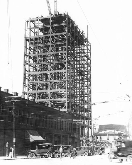
- Thomas Jefferson Hotel (also known as Cabana Hotel and Leer Tower)
- 100-120: Innovation Depot (former Sears Roebuck & Company)
- 2nd Avenue North intersection
- former location of the Royal Restaurant
- 206: former location of Ella Wilson restaurant (1904)
- 216: former location of Kentucky Livery Co. (1926)
- 209: former location of W. J. Schimmel, veterinarian & horse shoer (1923)
- 3rd Avenue North intersection
- former location of Modern Sign Company
- 306-310: former location of Independent Laundry Co. (1926)
- 312: Homecoming Coffee & Gift Shop
- 314: former location of Treat-Rite store (1927)
- 320: Ferrill African Wear (2017-), former location of The Vault Clothiers
- 328: Mrs B's On Fourth
- 4th Avenue North intersection
- A. G. Gaston Building
- 413: Office of attorney Alfreda Gray
- 414: former location of D. M. Wilson vehicle service (1926)
- 415: former location of Post Office Motor (1926)
- 419-431: former location of John Ray's Supper Club, Club Mozambique (1970s), Infinity Club Connection
- 5th Avenue North intersection
- 6th Avenue North intersection
- 16th Street Baptist Church
- former location of Jockey Boy Restaurant
- 611: former location of Birmingham Auto School (1926)
- 613: former location of C.J, Knighten contractor (1887)
- 614: former location of the Pettiford House
- 615: former location of Social Cleaners (1962)
- 616: former location of Bradford Funeral Home / Jefferson County Burial Society (1926)
- 7th Avenue North intersection
- 700: former location of Hill Grocery Co. (1926)
- 702: former location of Pinkey Lewis bar (1937)
- 730: former location of Edwards & Miles grocers (1887), S. A. Cohen & Son (1926)
- Reverend Abraham Woods Jr Boulevard North intersection
- 807: former location of Charles McDermott grocer (1887)
- I-20/I-59 (no interchange)
- 9th Avenue North intersection (east only)
- 900: Flowers Baking Company, former location of the Home Baking Company
- 909: former location of Hattie Taylor restaurant (1904)
- 10th Avenue North intersection
- 1034: former location of Great A & P Co. (1926)
- 11th Avenue North intersection
- 11th Court North intersection (east only)
- 12th Avenue North intersection
- 12th Court North intersection (west only)
- 13th Avenue North intersection
- 13th Court North intersection (west only)
- 14th Avenue North intersection
- 15th Avenue North intersection
- I-65 interchange (south only)
- 17th Street North intersection (north only)
- 16th Terrace North intersection
- 1884: Restoring The Kingdom Ministries
- 1904: former location of Mars Petcare
- 2001: former location of Dixie Packing Co. meat packers (1925), National Packing Co. (1926)
- 2011: former location of Dixie Meat Market (1926)
- 2109: Tire Centers Birmingham
- 2400: Motley Construction Company
- 2512: former location of Chubby's restaurant and lounge
- 2610: Eagle's Restaurant
- 2700: Birmingham Entertainment Center (also known as Club Chubbys), (2009-)
- 2713: former location of William Blakely restaurant / Centennial Social Club (1926-1928)
- 2811: former location of Martin Furniture & Clothing Co. (1926)
- 2815: former location of Acipco Repair Shop (1926)
- 2831: former location of Acipco Pharmacy / C. H. Smith physician (1926)
- 2901: former location of Acipco Auto Service Station (1926)
- 2905: former location of Acipco Art Cleaning (1926)
- 2907: former location of Hill Grocery Co. (1926)
- 2908-2916: former location of Acipco Co-Operative Store (1926)
- 2921: former location of American Cast Iron Pipe Co. (1926)
- 3117-3113: Acipco United Methodist Church (1926-)
- 3200: ACIPCO Medical Group