1st Avenue North (Downtown): Difference between revisions
Jump to navigation
Jump to search
| Line 288: | Line 288: | ||
==== [[22nd Street North|22nd Street]] intersection==== | ==== [[22nd Street North|22nd Street]] intersection==== | ||
* North side: | * North side: | ||
** 2200: [[Goodall-Brown | ** 2200: [[Goodall-Brown building]] (built 1905) for the [[Goodall-Brown Dry Goods Co.]]), [[Goodall-Brown Lofts]], former site of the [[Caldwell Hotel]] (1889-1894) | ||
*** 2200: [[Wine Loft]] | |||
** 2208-2210: former location of [[R. D. Burnett Cigar Company]] warehouse | ** 2208-2210: former location of [[R. D. Burnett Cigar Company]] warehouse | ||
** 2216-2218: former location of [[Todd-Witte Dry Goods Co.]] (1925) | ** 2212: former location of [[Bradford-Norton Co.]] (1926) | ||
** 2214: former location of [[Jaffe Clothing Co.]] (1926) | |||
** 2216-2218: former location of [[Todd-Witte Dry Goods Co.]] (1925-1926) | |||
** 2226: former location of [[Europa]] | ** 2226: former location of [[Europa]] | ||
** 2230: former location of [[Standard Oil]] gas station (1926) | |||
* South side: | * South side: | ||
** 2201: [[Transportation Building]] ([[ | ** 2201-2203: [[Transportation Building]] (built 1925 as the [[Southern Railway Building]]) | ||
** 2209: The [[Fanaei Building]] (formerly [[Slater Sales]]) | ** 2205: former location of [[T. W. Jones]] (1926) | ||
** 2213: former location of [[Steve Watson Restaurant]], [[W. G. Patterson Cigar Company|Patterson Cigar Store]] (1923) | ** 2207: former location of [[Auto Storage Tire & Battery Co.]] (1926) | ||
** 2209: The [[Fanaei Building]] (2007-), formerly [[Slater Sales]], former site of [[Ward Auto Supply Co.]] (1926) | |||
** 2211: former location of [[Liberty Overall Co.]] (1926) | |||
** 2213: former location of [[Steve Watson Restaurant]], [[W. G. Patterson Cigar Company|Patterson Cigar Store]] (1923), [[Birmingham Cash & Carry Cigar & Tobacco Co.]] (1926) | |||
** 2215: [[Krewe on First]] bar | ** 2215: [[Krewe on First]] bar | ||
** 2217: former location of [[Birmingham Wholesale Co.]] (1926) | |||
** 2219-2227: former location of [[Crawford's Auto Shop]] (1926) | |||
** 2229: former location of [[Winn-Snider Cigar Co.]] (1926) | |||
** 2231: former location of [[W. G. Patterson Cigar Company]] (1920s) | ** 2231: former location of [[W. G. Patterson Cigar Company]] (1920s) | ||
Revision as of 17:00, 26 March 2017
1st Avenue North (Downtown) is the section of 1st Avenue North running through downtown Birmingham's Fountain Heights and Central City neighborhoods, between 13th and 26th Streets. The street is also part of U.S. Highway 11.
In the downtown area, 1st Avenue North has a 100-foot right of way, 20 feet wider than the typical street. It carries two lanes of traffic in each direction with a central turn lane and parallel parking at each curb.
Locations
1st Avenue North continues west through Smithfield to Center Street, continuing as Cotton Avenue Southwest
Fountain Heights
13th Street intersection
- North side (Block 93)
- 1300: former location of Birmingham Fixture Manufacturing Co./Birmingham Pattern & Novelty Works (1926), Sharp Poultry & Eggs wholesaler (1960-1964)
- 1306: former location of Decca Distributing Co. record dealer (1960)
- 1308-1310: former location of Standard Bottle Co. (1926)
- 1308: Fashion Etc Hair Salon, former location of U.S. Department of Agriculture and Alabama Department of Agriculture offices (1960-1964)
- 1310: vacant (1998-), former location of Leonard's Restaurant & Lounge (1960), Trader Joe's restaurant & lounge (1964), Lynn's Den (1987-1998)
- 1310b: former location of Paul A. Pocopanni & Associates accountants (1964)
- 1312: empty slab (2017-), former location of Molay Bros. building supply (1960)
- 1314: former location of City Body & Paint Service (1964)
- 1316: former location of Jefferson Woodworking (1925-1926), Music Center One-Stop (2007)
- 1318-1322: Hibbett Sports team sales
- 1318: former location of Lilly-Flag Feed Co. (1923-1926), Sterling Distributors warehouse (1960-1964)
- 1320-1324: former location of Universal Printing Co. (1960-1964)
- 1324: former location of Siphonmix Fountain Co. (1926), The Plate Shop lithographers (1964)
- 1326: former location of San-Nox Chemical Co. (1926), Sterling Distributors wholesale beer (1960-1964)
- 1330: former location of Birmingham Motor Exchange (1960), Birmingham Motor Transmission Service (1964)
- South side (Block 111A)
- 1301: The Elegant Earth warehouse, former location of W. H. Adams Flower & Grain Co. (1926), Buffalo Electric Co. (1960-1964)
- 1303: Ebsco Engineering, former location of Tennessee Coal, Iron & Railroad Company central vault (1926), Discount Television (1964)
- 1305: former location of ABC Store No. 76 (1960)
- 1307-1309: former location of Addressograph-Multigraph Corp. branch office (1960)
- 1307: former location of Blackburns Manufacturing Co. textiles (1964)
- 1309: former location of ABC Store No. 76
- 1331: Bailey's Corner gas station (Catch-out Corner), Tacos Dos Hermanos, former location of Spur gas station (1960-1966)
- North side (Block 93)
14th Street intersection
- North side (Block 94 & 95)
- 1500: Innovation Depot, former location of Sears Roebuck & Co. (1941-1990)
- 1530: former location of Central of Georgia Railroad and Illinois Central Railroad freight depot (1926)
- South side (Block 110A & 110B)
- 1401: former location of Cahaba Domestic Coal Co. (1926)
- 1405: former location of City Lumber Co. (1926)
- 1419: former location of Ward Baking Co. thrift store (1964)
- 1501: former location of Loose-Wiles Biscuit Co. (1925-1926)
- 1517-1519: former location of Sears Roebuck & Co. farm and garden store (built 1946)
- 1517: former location of Archives Security Inc. (2007)
- 1521: former location of Interstate Belting & Packing (1925), Noble-Bryant Packing & Manufacturing (1926), Harry Charles & Son pianos (1964)
- 1527: former location of Atlas Chemical Company janitorial supplies, Giles Warehouse & Transfer, and Whitaker Paper Co. (1964)
- 1529-1531: former location of Lawrenceburg Rollers Mills Co. (1926)
- 1529: former location of Southern Bell Telephone & Telegraph Co. training school (1964)
- North side (Block 94 & 95)
16th Street intersection
- North side (Block 96)
- 1600-1606: former location of Birmingham Electric Co. electrical department (1926)
- 1600: former location of Darnell's Downtown Gulf gas station (1964)
- 1606: former location of Nelson's Cafe (1964)
- 1608-1610: former location of Meyer-Blanke Co. (1926)
- 1612: former location of Allright Birmingham Co. parking lot (1964)
- 1616: former location of R. H. McLeod Plastering Co. (1926)
- 1620-1624: former location of Car Park Inc. parking lot (1964)
- 1620: former location of Alabama Paper & Metal Ware Co./Southern Wooden Ware Co. (1926)
- 1624: former location of Going Road Machinery Co./Imperial Candy Co./Williams Stacy Co. (1926)
- 1626: former location of Beesley Products Co. (1964), Babe's Hot Dogs (1985-1990), Erika's Beauty Unlimited (2007)
- 1628: former location of B. I. T. Cafe (1929), Term Financial Co. loans (1964)
- 1600-1606: former location of Birmingham Electric Co. electrical department (1926)
- North side (Block 109B)
- 1601: former location of Walters Brokerage Co./Donovan Provision Co./Diem & Wing Paper Co./Ormond Bros. Brokerage Co. (1926), Hendon Car Park parking lot (1964)
- 1605-1617: former location of Pizitz warehouse (1964)
- 1605-1607: former location of Beck Candy & Grocery Co. (1926)
- 1609-1611: former location of Goodyear Tire & Rubber (1925-1926)/Educational Exchange Co. (1926)
- 1613: former location of Tyler Grocery Co. (1926), Architectural Interiors, Jeffcoat Warehouse (2007)
- 1617-1619: former location of Magnus Grocery Co. (1926)
- 1619: former location of Beck Candy & Grocery Co. (1929)
- 1621: former location of Morton-Bowles & Co. merchandise brokers (1925-1926), Noble Bryant Co. mill supplies (1929), Birmingham Trust National Bank printing department (1964), American Armored Transport (2007)
- 1623: former Birmingham office of West Disinfecting Co. (1925-1929)
- 1625: former location of Deacon Brown Bottling Company (1911), Magic City Bottling & Syrup Co. (1911), Dixie Asbestos Co. (1925-1929), Salon Oni's
- 1627: former location of Sherwin-Williams Co. (1926), Enterprise Furniture Co. (1929), Wallace Fabrics drapery material (1964), Cabaret Event Center (2007)
- 1629: former location of E. J. Jones Grain Co./Jones Bros. Sales Co. (1926)
- 1631: Downtown Lounge, former location of Tennessee Biscuit Co. (1926), C. D. Kenney Coffee Company (1937)
- North side (Block 96)
17th Street intersection
- North side (Block 97)
- 1700: former location of Sinclair Filling Station (1937), Ralph Fowler's Service Station (1964)
- 1702-1708: former location of C. A. Bain Roofing & Sheet Metal Co. (1926)
- 1710: 1710 Building/Birmingham Police Headquarters (built 1928), former location of J. M. Wright & Co. (1926), Doster-Northington Drug Co. (1929), McKesson-Doster-Northington, Inc. wholesale drugs (1937), Southern Bell divisional office (1964)
- 1712-1714: former location of R. L. Sparkman & Co. (1926)
- 1714-1716: former location of G. A. Stowers furniture (1886-)
- 1714: former location of Boyd Manufacturing Company
- 1716: former location of Young & Vann Supply Co. belt shop (1926)
- 1718: former location of Welsh Vinegar & Extract Co. (1904), United Furniture Co. (1926)
- 1720: former location of Colby Decorating Co. (1926), Jason Clark Electrical Co. (1929), Billingsley-Duddy Inc. appliances (1964)
- 1722: former location of Boyd Manufacturing Co. (1926-1937), Seaboard Finance Co. (1964)
- 1724: former location of Doster-Worthington Drug Store (1929), Continental Commercial College (1970)
- 1726: former location of Birmingham Gas Appliance Co. (1964)
- 1728-1730: former location of Magic City Candy Co. (1925-1929), parking lot (1937)
- 1732: former location of Alabama Barber Supply Co. (1929-1937), Maytag Sales & Service (1964)
- 1723B: former location of Here Tiz Lunch Stand (1929)
- 1734: former location of Herring-Hall & Martin Safe Co. (1929), ABC Store No. 12 (1964)
- 1734½ : former location of Inn Hotel (1926)
- 1736: former location of Gulf States Life Building, Boyett's Cigar Store (1929), American Life Insurance Company of Alabama (1937), Wheeler Business College (1964)
- South side (Block 109A)
- 1701-1703: former location of M. C. McCoy Filling Station (1929), Lee Rodgers Garage
- 1701: former location of Hazard Manufacturing Co. (1926), Allright Birmingham Co. parking lot (1964)
- 1705: former location of W. P. Ballard & Co. dry cleaners (1926-1929), Watts-Newsome Company (1937)
- 1707-1709: former location of W. P. Brewer (1926), Jefferson Furniture Co. (1929), Alabama Paper & Metalware Company (1937), R. B. Broyles Furniture Co. warehouse (1964), He She Scene, Club Asia, Club Heat, Club Rave nightclubs
- 1711: former location of Erdreich Bros. & Marx liquors (1904), Kilgore Furniture Co. (1929), McKelvey-Coats Furniture Co. warehouse
- 1713-1715: former location of Ransom's Garage (1929), Standard Oil Gas & Garage (1937), First Avenue Garage (1964)
- 1717: former location of T. M. Nesbitt & Associates, Finance Inc., Nesbitt Agency, William R. Brown Manufacturing Co. (1964)
- 1721-1723: former location of Amzi Godden Co. warehouse (-1903), Birdwood Paper Co. (1964)
- 1721: former location of Alex Rontos Fruit Co. (1926) Talking Machine Co. (1929)
- 1723: former location of Birmingham Woodenware Company (1926-1939), Magic Palace
- 1725-1731: Young & Vann Building (built 1899), offices of the Alabama Media Group (2014-), formerly the Meyer-Marx Co. wholesale beverages & cigars (1899-), Young & Vann Supply Company's mill & mine warehouse (1912-1926), Center for Regional Planning and Design (2002-2014)
- 1701-1703: former location of M. C. McCoy Filling Station (1929), Lee Rodgers Garage
- North side (Block 97)
18th Street intersection
- North side (Block 98)
- 1800-1812: Pizitz parking deck (1965), former location of Shoppers' Park Lot (-1964)
- 1800: former location of Louis Hotel & Cafe (1926), Manhattan Cafe (1929),
- 1802: former location of Jacob Joseph (1926), Clothing & Shoe Store (1929), Paint & Hardware (1937), Car Park Inc. (-1964)
- 1804-1806: former location of National Baking & Lunch Co. (1926), Pandora Cafeteria (1929), Sears Roebuck & Co. parking & auto accessories (1937)
- 1806: former location of Traveler's Home hotel (1887)
- 1808: former location of I. R. Hochstadter wholesale liquors, Sarah King (1926), Chinese Restaurant (1937)
- 1810: former location of Sol Fleisher (1926), ABC Store #12 (1937)
- 1812: Amway Batts Distributing Co., former location of Mendolsohn & Sons (1926), T. P. Raley (1929), Magic City Barber Supplies (1937), Batts Services (2007)
- 1814: former location of Samuel Goldstein (1926), Central Loan Office (1929), Shook & Fletcher Supply Company (1937-1964)
- 1816: former location of Belmont Hotel (1887), Samuel Adelson/J. J. Cantelou (1926), B & B Store (1929), parking lot (1937)
- 1818-1822: former location of Sokol Brothers furniture (1937), Sokol's (1949), Spencer Furniture
- 1818: former location of Moses Damsky (1926)
- 1820: former location of Tanner & Elledye saloon, Lichter Bros. (1926), Sokol Brothers clothing (1937)
- 1822: former location of J. E. Fleisher (1926), Whaley Furniture Co. (1929)
- 1824-1832: former location of O'Brien Opera House, Molton-Henley Retail Block, Expanded Sokol's store
- 1824: former location of Jacob Demby (1926), Old Clothing Store (1929)
- 1824½: former location of Battle Creek Treatment Rooms (1926)
- 1826: former location of Watches Jewelry Repairing Store (1929), H. M. Park real estate (1964)
- 1830: former location of J. D. Arbetter (1926), Goodyear Welt Shoe Repairing (1929)
- 1832: former location of Philip Lipez/T. S. Larney (1296), I. Goldburg Store (1929)
- 1834: former location of K. D. Likes Confectionary (1929)
- 1824: former location of Jacob Demby (1926), Old Clothing Store (1929)
- 1800-1812: Pizitz parking deck (1965), former location of Shoppers' Park Lot (-1964)
- South side
- 1801-1803: former location of Hotel Royal (1887-), Alabama Grocery Company, Alabama Appliance Company (1937)
- 1801: former location of Earle Brothers wholesale grocers (1926-1929),
- 1805-1807: former location of Renard Rubber Co. (1929), Haverty Furniture warehouse (1937)
- 1805: former location of Chicago Pneumatic Tool Co. (1926)
- 1807: former location of Herring-Hall-Marvin Safe Co. (1926)
- 1809-1811: S. J. Bennett Professional Building (demolished 2008-2013), former location of U. S. Rubber Co. (1926), Kee School of Real Estate (2007), Turner Realty, Loder PC attorneys, Tyme Mortgage, W. L. Williams Jr attorney)
- 1809: former location of Sokol Brothers warehouse (1937)
- 1811: Action Printing & Supply (2007), former location of Bay Theatre, Veltex Co. (1937-1964)
- 1815-1819: former location of National Birmingham Garage (1937-1964), Budget Rent-A-Car (1964)
- 1815: former location of W. G. Patterson Cigar Store (1929)
- 1817: former location of B. D. Davidson (1926), Birmingham Refrigeration Co. (1929), Highland Cleaners (1937), Matthews Electric Company, Independent Reciprocal Exchange & Commonwealth Life & Accident insurers (1964)
- 1819: former location of Birmingham Auto Laundry/Magic City Plumbing & Heating (1926), Electrical Speciality (1929), Roberts Electric (1937), Modern Home Engineers appliances (1948), Robert P. Parker real estate & Joseph A. Miller, Jr civil engineer (1964)
- 1821-1823: former location of Matthews Electric Supply Co. (1926)
- 1823: former location of Golbro store, Goldstein Brothers Inc. (1964)
- 1825: former location of Hollywood Realty Co. (1926)
- 1827-1831: Jemison Flats (built 1909 as the Lincoln Life Building), former site of the Chalifoux Building (1893-1907)
- 1827: former location of Home Seekers Realty Co. (1926), National Finance & Discount Co. (1964)
- 1829: former location of P. C. Couch (1926), Lincoln Life Barber Shop (1929)
- 1831: former location of Whittington Drug Co. (1926-1929)
- 1801-1803: former location of Hotel Royal (1887-), Alabama Grocery Company, Alabama Appliance Company (1937)
- North side (Block 98)
Central City neighborhood
19th Street intersection
- North side (Block 99)
- 1900-1904: Saks building (built 1895), former location of the Marre building (1872-1895)
- 1900: Ruby Saloon (1880s), Louis Saks Clothing Store (1895-1916), Spielberger Brothers (1916), Ideal Millinery Cloak and Suit Store (1926), Doster-Northington Drug Store (1929), Morris Jewelers (1948-1964)
- 1902: former location of Old Gold and lunch counter (1937), Marvin Hawkins Pen Store, The Underground nightclub (1974)
- 1902a: former location of Birmingham Hearing Center, Marshall Allen optometrist (1964)
- 1904: Coyote Logistics (2015-), former location of George Hammersmith jeweler (1884), Boxers Bakery & lunch room (1926-1929), European Bakery (1937), Model Sales Co. clothier (1964), Childcare Resources (2000s), Corporate Realty (2005-2015)
- 1906: former location of Hochstadter & Wise wholesale liquors (1875-1884), Iron City Exchange (1884-), Max Roseman (1926), Linnehaw Jewelry Store (1937), Roseman's Shoes (1929), Dial Finance Co. (1964)
- 1908-1914: parking lot
- 1908: former location of Baltimore One-Price Clothing Co. (1893), J. Friedman & Co. mens' wear, Vaughn's Men's Clothing (1929), Lichter Department Store / Lichter's Magic Credit (1937-1964)
- 1910: Bishop Colvin Johnson & Kent attorneys, former location of Sacks Shoe Store (1926), Outlet Shoe Store (1929), Robertson Hardware Company (1937), Lipsitz Credit Clothiers (1964)
- 1912: former location of D. & H. Rich (1926), Standard Clothing Company (1937), Standard Furniture Co. (1964)
- 1912½: former offices of The Evening Chronicle (1883-1890)
- 1914: former location of Sommer Tailoring Co. (1925), Guarantee Leather Co./Guarantee Hardware & Paint Co. (1926), Guarantee Hardware & Paint Co. (1929), Standard Furniture Co. (1937)
- 1916-1920: L. F. M. Stoves (1926)
- 1916: former location of King Tailoring (1904), L. F. & M. Store dry goods (1925), Alabama Home Furniture Co. (1937), McCauley's Furniture (1964)
- 1918-1924: Alabama Gas Corporation building Marriott Hotel, former location of Birmingham Gas Company (1937), Alabama Gas Corp. (1964)
- 1918:
- 1918½ : former location of John Westbrook's mercantile and lime kiln (1880s)
- 1922-1924: former location of Porter Clothing Company (1925-1926)
- 1922: former location of Palace Royal saloon (1880s), Bank for Savings and Trust (1937), and Putta-Links indoor golf
- 1924: former location of L. H. Schmid sewing machines & jeweler (1884)
- 1918:
- 1926: former location of H. Houpt steamship agent & jeweler (1884), Chris's Place restaurant (1909-1934), Empire Steak House (1934-1944), Top that Chick, Seven Seas Seafood (1956-1964), Toby's (1999-2007)
- 1928-1930: Empire Building (built 1909)
- 1928: Empire Hotel (2016-)
- 1930: former location of Bank Saloon (1883-1908), Empire Cafe/Brown's Cigar Store (1900s), Patterson's Cigar & Soda Store (1929), Greene Drug Company (1917-1937), City National Bank (1965-1982), Colonial Bank (1982-2009)
- 1900-1904: Saks building (built 1895), former location of the Marre building (1872-1895)

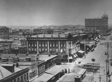
1890s view looking east down 1st Avenue, possibly from the Morris Block.
- South side
- 1901-1911: Allright Parking Garage
- 1901-1907: former location of Morris Block//Morris Hotel (built 1891, demolished 1958)
- 1901: former location of Meyer-Engel Real Estate (1926-1929), Morris Tavern (1937)
- 1903: former location of J. H. Huffman (1926), New Morris Barber Shop (1929-1939), Morris Jewelers
- 1905: former location of Morris Hotel entrance (1894-1958)
- 1907: former location of Davison Electric Co. (1929), Woodward Billiard Parlor (1937)
- 1909: former site of Allen Building (1880s), former location of Venable's Cafe (1926), Engel Realty Co. (1937)
- 1909½: former location of W. S. Smith & Co. architects /Alexander & Corpening brokers (1888), Allen & Co./Bonazzi & Co./J. G. McCall/J. L. Pounds/Queen City Printing Ink Co./Southern Social & Literary Club (1926)
- 1911: former location of Marc Linx Men's Clothing, Marc Linx Tailors (1926-1964)
- 1911½: former location of DuBois & Webb (1893), Osce Robert's Stamp & Printing Co. (1926)
- 1901-1907: former location of Morris Block//Morris Hotel (built 1891, demolished 1958)
- 1909-1917: former site of Potter Building (sold 1964), former location of Wheeler Business College (1888-)
- 1913-1917: former location of Britling Cafeteria No. 1 (1919-1964)
- 1917a: former location of Artists Recording Company / Reed Records (1956-1960s)
- 1919: former location of Western Union (1926-1929), Robert Dickerson portrait studio (1954-)
- 1921: former location of the Evening Chronicle / Sunday Chronicle (1883-1890), A. R. Dearborn & Co. (1897), llinois Central Railroad ticket office, People's Tailors (1926-1937)
- 1923: former location of Berney National Bank (1885-1901), Uhrig Optical Co. (1925-1926), Powder Puff Beauty Shop (1926), Bandman-Marx tailors, Shrib Optical Co. (1937), Budget Finance Corp. (1964)
- 1923a: former location of J. F. Clark & Co. (1926), Smile Cafe (1929), Lontos Cafe (1937), New Lontos Cafe (1939), Salvador's Restaurant (1964)
- 1925: former location of Taccone's Barber Shop and Bath House (1893), R. A. Brown & Co./Underwriters Laboratories of Chicago (1926), Frisco Lines ticket office (1937) Tinder Optical Co. (1964)
- 1927: Woodward Building (built 1902), former location of Hewlett Block (burned 1900)
- 1927: PNC Bank, former location of J. H. Tinder & Sons (1926), Hugh Price Opticians (1964), MetroBank
- 1901-1911: Allright Parking Garage
20th Street intersection: Heaviest Corner on Earth
- North side (Block 100)
- 2000-2010: Brown Marx Building (built 1906, expanded in 1908), former site of National Bank of Birmingham building (Linn's Folly, built 1873)
- 2000: former location of cigar store (1929)
- 2004-2006: former location of W. C. Reese dry goods & shoes (1884)
- 2004: former location of Western Union telegraph office (1926-1937)
- 2006: former location of Windsor Hotel (1887)
- 2008: former location of Walter Beasley restaurant (1928), Simon Klotz insurance office (1929), Steiner-Rouse & Co brokers (1964)
- 2010: former location of Birmingham Post Office (1880s), Harry Mercer jeweler (1893), Central of Georgia Railroad office (1926-1929), Fidelity Loan Company, American Plan Corp loans (1964)
- 2012: Brown Marx annex (built 1909), H2 Real Estate, former location of Gluck & Black jewelers (1888), R. A. Brown & Company real estate (1929-1937), Utopia Cleaners (1964)
- 2014: former location of Zac Smith Stationery Company (1922-1970s)
- 2016: former location of Paul Calame jeweler (1888), Glidden Paint Store (1926-1937), Gold Bond Gift Center (1964)
- 2018: former location of Oswald Hotel (1887), Amzi Godden Co. (1903-), Harris Floral Co. (1929), Kohlmeyer & Co. investment securities (1964)
- 2020-2022: former location of Esquire Parking Lot (1937-1964)
- 2020: former location of Robertson Hardware Co. (1925-1929)
- 2022: former location of Sorsby & Smith (1883), Smith & Montgomery (1884-1902), Zac Smith Stationery Company (1902-1922), J. H. Roll decorator and art glass (1905), Morris Supply Co. (1929)
- 2024: former location of Amzi Godden Co. (-1903), E. B. Peddinghaus photographer / Peddinghaus Studio (1910s), Alabama Home Co. (1929), Garber, Cook & Hulsey (1937)
- 2026: former location of A. Hirsch & Co. dressmakers (1884), Hewitt, Walker & Porter attorneys (1880s), Alabama Home Building & Loan Association, Birmingham Federal Savings and Loan
- 2028: former location of George Scott tailor (1886-), Harrison Richardson contractor (1927)
- 2030: former location of Parisian Dry Goods & Millinery (1888), Patterson Cigar Store (1929), Sarris Grill (1937), Guaranty Federal Savings and Loan (1960-1990), New City Church (1995-2010), Birmingham Healthcare (2010), Lewis Communications (2015-)
- 2000-2010: Brown Marx Building (built 1906, expanded in 1908), former site of National Bank of Birmingham building (Linn's Folly, built 1873)
- South side (Block 107)
- 2001-2009: John A. Hand Building (built 1912)
- 2005: former location of Hardy & Co. stock brokers, R. G. Dun & Co. credit rating agency, Adams, Meade & Co. bankers (1888)
- 2007: former location of Dearborn & Co. and John G. Smith & Co. real estate (1888)
- 2009: former offices of Wilda & Dearborn real estate brokers
- 2011-2017: Condominium redevelopment by Orchestra Partners (2017-)
- 2011-2013: McAdory Building (built 1888)
- 2011: former location of Perry-Mason Shoe Co. and D. A. Childs & Co. dry goods (1888-) Wimberly & Thomas Hardware (1905-1937), Billiard Parlor for Guys and Dolls (1977)
- 2013: former location of Birmingham Hardware & Gas Co. (1929), James A. Head & Co. office supplies (1937-1964)
- 2015-2017: Caldwell-Milner Building (built 1887)
- 2015: former location of W. H. Morris & Son (1897), Batiste & Associates, Brooks Electric Co. (1929), Central Bank (1964), MetroBank (1970s)
- 2017: former location of Minnegerode & Ellerbe machinery dealers, Sutcliffe, Armstrong & Willett Architects, and M. G. Hudson & Co. (1888), Wilcox Electric Co. (1926), Mazer's office & store equipment (1964-1976)
- 2011-2013: McAdory Building (built 1888)
- 2019-2021: parking lot, former location of Alverson Business College, Seals Piano Company, Allright Parking parking lot (1964)
- 2019: former location of Underwood Typewriters (1926-1937)
- 2021: former location of Rand Kardex Sales Co./Library Bureau/Safe Cabinet Co. (1926), James A. Head & Co. office furniture (1929), Birmingham Rug & Linoleum (1937)
- 2021½: Alverson Business College (1926)
- 2023: AccuPrint (1998-), former location of William Parish's art studio, W. D. Colby Decorating Co. (1903), Colby & Roll, Brown's Light House electrical repair (1929), Simmons Electric (1937), Berney Perry & Co. investment brokers (1964)
- 2025: Skyline Lofts, former location of Amzi Godden Co. (-1903), Zac Smith Stationery Company printing department (1926-1929), Reprint Company (1937-1964)
- 2027-2031: Protective Life building / Commerce Center (built 1928), former site of the Birmingham Ledger building (built 1902)
- 2027: former location of Southern Brotherhood of Locomotive Engineers (1926)
- 2031: former location of the Brotherhood of Locomotive Engineers Bank & Trust Co. (1926)
- 2001-2009: John A. Hand Building (built 1912)
21st Street intersection (Rainbow Viaduct)
- North side (Block 101)
- 2100: Landmark Center (built 1915 as Birmingham Railway, Light & Power Building), former site of Slaton, McGlathery & Burwell (1884), Birmingham Railway, Light and Power Co. (1902-1914), Birmingham Electric Company (1926)
- 2104-2106: former location of Alabama Dry Goods Co. (1925-1926), I. A. Kronenberg & Sons (1926)
- 2104: parking lot, former location of Birmingham Athletic Club (1895-1903), R. P. McDavid Company radios & refrigerators (1937), Magic City Barber & Beauty Supply (1964)
- 2106-2110: former location of Doster-Northington Inc. laboratory supplies & surgical instruments (1925-1926)
- 2106: former location of American Floor Covering Co. / Rug Mart (1964)
- 2108-2110: former location of W. F. Orr livery stable (1884), Morris Greenhouses, Abernathy Furniture Co., Haverty Furnitrure Co. (1929), Alabama Gas Company billing office (1964)
- 2112: Birmingham Realty Annex, Porter Billing Services / Capital Partners Leasing, former location of Protective Life Insurance (1926), Employers Insurance Company
- 2114-2116: former location of Gus Dugger Saloon, photo studio, Birmingham Water Works Board (1926-1964)
- 2114: former location of Greater Birmingham Arts Alliance (1978)
- 2118: Birmingham Realty Company building (built 1905), Birmingham Realty Company (1905-1964) / Dolcito Quarry offices (1964), former location of Alexander & Dryer drug store (1888)
- 2120: former location of Mrs S. E. Laird notions (1884)
- 2122: former location of A. A. Adams & Co. (1929), D. D. Metcalf Realty Co. (1964)
- 2124: former location of H. M. Archibald Jr "The Bond Man" (1925), Fidelity Building & Loan Association (1929), Franklin-Patton Real Estate & Insurance Co. (1964)
- 2126: former location of Tillman-Levenson furniture store, Millsap-Woodruff Co. (1929), Car Park Inc. parking lot (1964)
- 2028: former location of Stevens Barber Shop (1964)
- 2130: former location of Peter Apostolos restaurant (1926-1928), Olympia Cafe (1929), Burchwell Co. mortgage loans / Gerry G. McIntyre real estate / Howell Realty Co. (1964)
- South side
- 2101: Steiner Building (built 1890), former site of William Nabers shop (1869-1890)
- 2103: former location of Franklin-Patton Real Estate & Insurance Co./Security Mortgage Co./Vulcan Tile & Brick Co. (1926) Vulcan Tile & Brick Co. (1926-1929), barber shop (1937), 4-Way Finance Co. (1948), Merit Finance Co. (1964)
- 2105-2107: parking lot, former site of Bradford-Norton, Inc. millinery (1937) and Tillman-Levenson
- 2105: former location of Silverfield & Levin clothing (1925-1926)
- 2107: former location of Markstein Bros. Millenery Co. (1926)
- 2109: former location of McDavid Real Estate & Insurance Co./McDavid-Quinn Construction Co./Dillard Real Estate & Insurance Co. (1926), McDavid, Terry & Garland real estate agents, Wood & Hawkins real estate / Morris Marb Shoes Co. (1929), Credit Service Corp. (1964)
- 2111: former location of Burger Realty & Insurance Co./Engineers Supply Co./Charles Meis Shoe Co./S. G. Newberger/Reserve Loan Life Insurance Co./H. R. Wilcox (1926), Franklin & Parton real estate (1929), Typewriter Exchange, Regal's Watch Repair (1964)
- 2111B: former location of Scott Realty Co. (1929), Jefferson Sea Food Café, Alex's Sandwich Shop (1964)
- 2113: Atomic Lounge (2017-), former location of Standard Jewelry (1926-1929), Patton-Harris Co. blueprints (1964)
- 2115: former location of Edwards Cotten & Co./Hamilton Autographic Register Co./William H. Keller Inc./Mills Representative Co. (1926), Enslen Real Estate & Insurance Co. (1926-1929), Jay Novelty Co. wholesale jewelry (1964)
- 2117: former location of Vulcan Paint Company (1905), Birmingham Map Co. / Sowell Insurance / Jeromine Tucker insurance (1929), F. T. Skelton & Co. jewelry repair (1964)
- 2119: former location of Manufacturing Co. of Alabama / Manufacturing Purchasing Co. of Birmingham (1929), U.S. Army Reserve 87th Maneuver Area Command headquarters (1964)
- 2121: former location of Temerson Bros. (1926), Blumburg Dry Goods Co. (1929), Magnolia Diamonds jewelers (1964), Body & Soul Fitness (2005-)
- 2123: former location of Silverstein Bros. ladies wear (1926-1929), Gem Jewelry Co. wholesalers (1964)
- 2125-2127: former location of J. M. Haran Plumbing Co. (1905)
- 2125: former location of Cooper Dry Goods Co. (1929), Alabama Restaurant Supply storage (1964)
- 2127: former location of Star Hosiery & Underwear Co. (1929), Alabama Restaurant Supply (1964)
- 2129-2131: former location of Dixie Store Fixtures (1964)
- 2131: former location of Frankel & Feldstein Clothing Co. (1929)
22nd Street intersection
- North side:
- 2200: Goodall-Brown building (built 1905) for the Goodall-Brown Dry Goods Co.), Goodall-Brown Lofts, former site of the Caldwell Hotel (1889-1894)
- 2200: Wine Loft
- 2208-2210: former location of R. D. Burnett Cigar Company warehouse
- 2212: former location of Bradford-Norton Co. (1926)
- 2214: former location of Jaffe Clothing Co. (1926)
- 2216-2218: former location of Todd-Witte Dry Goods Co. (1925-1926)
- 2226: former location of Europa
- 2230: former location of Standard Oil gas station (1926)
- 2200: Goodall-Brown building (built 1905) for the Goodall-Brown Dry Goods Co.), Goodall-Brown Lofts, former site of the Caldwell Hotel (1889-1894)
- South side:
- 2201-2203: Transportation Building (built 1925 as the Southern Railway Building)
- 2205: former location of T. W. Jones (1926)
- 2207: former location of Auto Storage Tire & Battery Co. (1926)
- 2209: The Fanaei Building (2007-), formerly Slater Sales, former site of Ward Auto Supply Co. (1926)
- 2211: former location of Liberty Overall Co. (1926)
- 2213: former location of Steve Watson Restaurant, Patterson Cigar Store (1923), Birmingham Cash & Carry Cigar & Tobacco Co. (1926)
- 2215: Krewe on First bar
- 2217: former location of Birmingham Wholesale Co. (1926)
- 2219-2227: former location of Crawford's Auto Shop (1926)
- 2229: former location of Winn-Snider Cigar Co. (1926)
- 2231: former location of W. G. Patterson Cigar Company (1920s)
23rd Street intersection
- North side (Block 103)
- former location of the Winnie Davis Wigwam (1894)
- 2300-2302: Fix Play Lofts, former location of Fix Play Displays (1964)
- 2300: 1st & 23rd (2006-), former location of Phillips-Lester Manufacturing, maker of 401 brand overalls (1925-1929)
- 2300 (rear): Birmingham Oddities
- 2302: former location of Hutchins Co. clothes (1929)
- 2300: 1st & 23rd (2006-), former location of Phillips-Lester Manufacturing, maker of 401 brand overalls (1925-1929)
- 2304: former location of Wynn-Knox Candy Co. (1929), Jaffe Dry Goods (1964)
- 2306: former location of Levine-Abelson Candy and Grocery Company (1929)
- 2308-2314: 2314 1st Avenue North building, former location of The Feldstein Co. wholesale clothing (1964)
- 2308: former location of Markstein Millinery (1929)
- 2310: Neighborhood Market, former location of D. Friedman & Co. dresses & coats (1929)
- 2312: former location of Frankel & Feldstein Clothing Co. (1929), S. & L. Garment Co. (1948), Weld for Birmingham (2011-2016)
- 2314: former office of James Morgan Jr
- 2316-2318: The Avenues Lofts, former location of Java Tea Company (1925)
- 2316: former location of Star Hosiery & Underwear Co. (1948-1964)
- 2318: former location of Greenwald Shoe Co. (1948-1964)
- 2320-2322: Raymond Rose Building, former location of Rose Commission Co. wholesale dry goods, Raymond Hosiery Co. & Raymond-Temerson Co. (1964), Alabama Uniforms
- 2320: Tavern on 1st (2015-)
- 2324: Mike's Fine Jewelry & Music Center (1965-)
- South side (Block 107)
- 2301-2303: Liberty House Lofts (built 1909 for Collins & Co. wholesale grocers, Packard automobile dealership, Liberty Overall Company factory and store, converted to lofts in 1990s)
- 2305: former location of Morris & Company ham, bacon & lard (1925)
- 2307: former location of Cudahy Packing Co. of Alabama meatpackers (1925)
- 2321-2325: Wooster Lofts
- 2321: former location of Wood-Frutticher Grocery Co. (1930s)
- 2323: What's on 2nd (2016-), former location of Cafe Lanetta
- 2325: Phillip Griffith Photography, former location of Reed Books
- 2329: Wooten Lofts
24th Street intersection
- 2400: United Trophy & Specialties
- 2401: Security Bonded Warehouse, former location of Batterton Coffee Company (1925) Royal Cup building
- 2411: ABC Foodservice Equipment
- 2413: From Darkness to Light Biblical Counseling Ministries
- 2416: Johnston Lofts, former location of Johnston Manufacturing Co. (1930s), Standard Distributors (1980s)
- 2420: Mr Burch formal wear
- 2425: Dixie Fixtures
- 2429: Blackwell Furniture/BB's China and Glassware
- 2431: former location of A & P's "East Side Downtown Super Market" (1944-)
25th Street intersection
- 2500: Roger's Trading Company Building (Vazda Studios, Intermark Interactive, formerly Crawford's Auto Shop, Maring-Crawford Ford and Roger's Army Navy Store)
- 2506: former location of Peyton King residence
- 2532: former location of Fleck's Pharmacy (1925)
- Red Mountain Expressway overpass (former site of Birmingham Farmer's Market)
- Carraway Boulevard intersection
- 2600: former location of Twenty-First Ave. Drug Co. (1925)
- 2620: former location of Banks Lounge
- 2628: former location of Henry Bozzelf restaurant (1910)
- 2630: former location of Industrial Home for Stranded Men (1925)
- 2728: former location of Frederick Broderick restaurant (1910)
- 1st Avenue North continues east through North Avondale, Woodlawn, Wahouma, and East Lake to West Boulevard, continuing as Parkway East